Wednesday, January 26, 2011

Fort Pickens - Santa Rosa Island, Florida

Fort Pickens
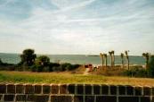
Battered over the years by hurricane, war and even a massive accidental explosion, the old brick walls of Fort Pickens continue to defy man and the elements at the western end of Florida's beautiful Santa Rosa Island.

Surrounded by the most beautiful beaches in the world, the brick walls of the historic fort stand in stark contrast to the gleaming white sands that attract millions of visitors to Northwest Florida each year. It is a little known fact that Fort Pickens was almost the spot where the Civil War began 150 years ago.

Aware that state troops from Alabama and Florida were gathering to seize the fortifications at Pensacola Bay, Lieutenant Adam J. Slemmer of the U.S. Army moved his tiny garrison across the bay from Fort Barrancas on the mainland to Fort Pickens on Santa Rosa Island in January of 1861. With fewer than 100 men, he held the fort and refused three demands that he surrender from Colonel William H. Chase, who commanded the growing force of Southern troops arrayed against the fort.

Fort Pickens
Built in 1829-1834, the huge five-sided fort was designed to sweep the entrance to Pensacola Bay with the fire of hundreds of cannon. With Fort McRee across the channel and Fort Barrancas on the mainland, it presented a formidable defense against any attack by a foreign navy. In Union hands, however, the fort also bottled up the entrance to Pensacola Bay preventing Southern forces from making use of the harbor there and the outstanding navy yard captured from Federal forces.

With more than 1,000 men at his disposal, Colonel Chase was moving in the direction of storming the fort and taking it from its small garrison when, unexpectedly, President James Buchanan agreed to the so-called "Fort Pickens Truce" on January 29, 1861. The truce provided that Federal forces would not try to reinforce the fort so long as Southern troops did not move against it. The agreement halted militia forces in their tracks and prevented the looming battle at Fort Pickens from taking place. Bloodshed was averted, but Fort Pickens would remain in Union hands throughout the war and Pensacola as a port was of no use to the Confederacy.

To learn more about Fort Pickens, please visit www.exploresouthernhistory.com/fortpickens1.

Wednesday, January 19, 2011

An Eyewitness Account of the Nancy Harts - LaGrange, Georgia

Home of 2nd Lieutenant, Mrs. Peter Heard
The events commemorating the 150th anniversary of the beginning of the Civil War reminded me of one of my favorite stories about the war, the almost legendary tale of the Nancy Harts.

The Nancy Harts, as the story goes, were an all female military company that organized in LaGrange, Georgia, to defend the city against Union raiders. Most of the city's men and boys were away in the Confederate service and the community was only lightly defended, so the women of LaGrange took it upon themselves to provide for their own defense. They gave their company the name of Georgia's legendary female fighter of the American Revolution, Nancy Hart.

They drilled regularly under the direction of a disabled Confederate soldier and became quite proficient in their marksmanship and military order. The legend continues that when Union troops approached the city in 1865 during Wilson's Raid, the Nancy Harts formed ranks and marched out to meet them. A truce was negotiated, however, and bloodshed was averted.

It is a fascinating legend and I recently came across an 1861 account of the actual formation and naming of Georgia's all female Confederate company. The article first appeared in the LaGrange Reporter, but was reprinted by the Atlanta Southern Confederacy a few days later:

The Company Drilled near Belleview House
June 1, 1861,
Southern Confederacy (Atlanta), p. 2.

The “Nancy Harts” of LaGrange.

We are informed that the ladies of LaGrange, to the number of about forty organized themselves, on Saturday last, into a military corps for the purpose of drilling and target practice. They elected Dr. A.C. Ware as their Captain; and, we believe, resolved to meet every Saturday. The following are their officers:

Dr. A.C. Ware, Captain
Mrs. Nannia Morgan, First Lieutenant
  Peter A. Heard, Second Lieutenant
Miss Aley Smith, Third Lieutenant.
“ Andelle Bull, First Sergeant.
“ Augusta Hill, Second Sergeant.
“ M.E. Colquitt, Third Sergeant.
“ Pack Beall, First Corporal
“ Lelia Pullen, Second Corporal
“ Sallie Bull, Third Corporal.
“ Ella Key, Treasurer.

The corps not having a name, and it being their determination to prepare to defend their homes, if necessary, as did Nancy Hart of olden time, we have taken the liberty of calling them the “Nancy Harts” until they shall adopt one. We have no doubt they will prove as true as did Nancy Hart if the emergency ever presents itself; and, therefore, we do not think a more appropriate name could be suggested. The “Nancy harts” of LaGrange! That’s it, ladies. – LaGrange Reporter.

To learn more about the Nancy Harts, please visit www.exploresouthernhistory.com/nancyharts.

Saturday, January 15, 2011

Key West Lighthouse - Key West, Florida

Photo by Lauren Pitone
Built in 1847-1849, the Key West Lighthouse is one of the most elegant such towers that dot the Southern coastline.

Located in the island city of Key West at the southern tip of Florida, the lighthouse replaced an earlier structure that was demolished in the Great Hurricane of 1846. A number of people had taken shelter in the original tower, hoping that its strong brick walls would protect them from the wind and waves of the storm. When it collapsed, fourteen people died, including six children of lighthouse keeper Barbara Mabrity.

Despite the tragedy, Mabrity stayed on to serve as keeper of the new lighthouse when it was completed in 1849. She remained on the job until the Civil War, when at the age of 82 her anti-Union statements caused her to lose her federal job.

The lighthouse was heightened to 86 feet, its present height, during the 1890s and remained in use until it was deactivated in 1969. Now operated by the Key West Art & Historical Society, it has been beautifully restored and is open to the public.

To learn more, please visit www.exploresouthernhistory.com/keywestlighthouse.

Monday, January 10, 2011

Eatonton, Georgia - Home of the Brer Rabbit Statue

Brer Rabbit Statue in Eatonton
One of the most unusual sights in the South is the full color statue of the famed mythical character Brer Rabbit on the lawn of the Putnam County Courthouse in Eatonton, Georgia.

Incorporated in 1809 and located 39 miles north of Macon and 77 miles southeast of Atlanta, Eatonton was the birthplace of beloved Southern writer Joel Chandler Harris. It was Harris who took stories he had heard from elderly slaves as he was growing up and preserved them on paper in his series of Uncle Remus books.

Many of the stories preserved by Harris actually bridge three cultures. The stories of the wily Brer Fox and the crafty Brer Rabbit actually have their foundation in the tales told long ago by Creek Indian elders who amused villagers by bringing to life the creatures of the forest around them. These tales captivated African American story tellers as settlement and slavery spread west into the lands of the Creek Nation and the stories continued to be told even after most of the Creeks were moved west on the Trail of Tears.

Uncle Remus Museum
So far as is known, Harris was the first person to put many of the old stories down on paper (while also creating some new ones of his own). He used the figure of an elderly slave named Uncle Remus to tell the stories and both Uncle Remus and the fanciful characters of the tales become beloved fixtures of American literature.

Eatonton is the perfect place to explore this unique part of Southern literary history. In addition to the Brer Rabbit Statue on the courthouse lawn, the town is home to the Uncle Remus Museum which preserves the stories and details the early life of Joel Chandler Harris.

The town is also located near the famed Rock Eagle Effigy Mound, one of only two verified stone effigy mounds east of the Mississippi River. The nearby Rock Hawk, also now open to the public, is the other.

Eatonton is on the trail of Sherman's March to the Sea and the vicinity is rich in Civil War history. To learn more, please visit www.exploresouthernhistory.com/eatonton.

Saturday, January 8, 2011

Crossing of the Dan - South Boston, Virginia

Site of the Crossing of the Dan
One of the greatest military accomplishments of the American Revolution was not a battle, but a retreat.

In January and February of 1781, American General Nathaniel Greene led his army across North Carolina and into Virginia in what became known as the "Race to the Dan." The race was against the larger and much better equipped army of Lieutenant General Charles, Lord Cornwallis, the British commander in the South.

Greene's subordinate, General Daniel Morgan, had achieved a stunning victory over a British force led by Lieutenant Colonel Banastre Tarleton at the Battle of Cowpens, South Carolina, on January 20, 1781. Not only was "Bloody Ban" Tarleton driven from the field, but more than 300 of his men were killed and wounded and another 630 taken prisoner.

Taking the prisoners and captured supplies and turning north, Morgan reunited with the main army under Greene and the Americans started a rapid retreat north across North Carolina. Aware the Cornwallis would be desperate to rescued the captured British soldiers and that they could not hope to stand against his main army, the Patriot generals launched a race for the Dan River in Virginia. If they could reach and cross that natural barrier ahead of Cornwallis, they knew they could end their campaign with success.

Crossing of the Dan Exhibit
For nearly four weeks the Americans stayed just ahead of the oncoming British as they moved rapidly through North Carolina and into Virginia. Ferry boats were destroyed along the way and rear guard actions help hold the British back just long enough for Greene to reach the Dan.

On February 14, 1781, he led his army across on a flotilla of flats and boats, successfully outrunning Cornwallis and bringing the prisoners captured by Morgan across the river and to safety. The British reached the Dan River shortly after the Americans had completed their crossing, but had no way to cross after them. Cornwallis withdrew back into North Carolina.

To learn more about Greene's great accomplishment and to see photos of the Crossing of the Dan Exhibit in South Boston, Virginia, please visit www.exploresouthernhistory.com/crossingthedan.

(Photos by Heather LaBone)

Monday, January 3, 2011

Civil War Daily - A New Blog of Interest!

Fort Barrancas, Florida
I've launched a new blog that might be of interest as we observe the 150th anniversary of the Civil War (or War Between the States).

Civil War Daily can be found at http://civilwardaily.blogspot.com.

The site will feature daily posts on the events, battles, campaigns, people and places of the Civil War to help those with an interest in the military aspects of the conflict to learn more about the war as it happened, day by day, 150 years ago. Today's post, on the state seizure of Fort Pulaski, Georgia (January 3, 1861), is the first.

Fort Sumter in 1861
I hope to continue to post new articles daily (or as close to it as I can) for the next four years. I hope you will visit Civil War Daily regularly and join in posting comments, information, questions and otherwise discussing the military history of the war. The purpose of this site is to focus on military aspects only. There are plenty of other places to discuss (or argue about) the causes of the war, etc., but I thought it would be nice for those of us with an interest in military history to have a place to learn and share.

If you are in Florida or have an interest in Florida history, you might also be interested in a series that I have started at Civil War Florida on the military aspects of the secession of that state from the Union. You can read those at http://civilwarflorida.blogspot.com.

Sunday, December 26, 2010

The Evacuation of Fort Moultrie - December 26, 1860

Fort Moultrie, South Carolina
One of the first military events of the Civil War took place 150 years ago tonight when Major Robert Anderson and the U.S. garrison of Fort Moultrie, South Carolina, slipped across Charleston Harbor and occupied Fort Sumter.

It was a move, in Anderson's words, meant to "prevent the effusion in blood." In reality, it would lead to the outbreak of the bloodiest war in American history.

Fort Moultrie, located on Sullivan's Island across from Charleston, had long been the primary post for U.S. troops maintaining and garrisoning the forts that guarded the South Carolina harbor. Soldiers from William Tecumseh Sherman to Edgar Allen Poe had been stationed there and during the 1830s it had served as the prison for the famed Seminole warrior Osceola. His grave, in fact, can still be seen just outside the walls of the old brick fort.

1860 Sketch of Evacuation of Fort Moultrie
When South Carolina became the first Southern state to secede from the Union on December 20, 1860, Fort Moultrie was held by a small garrison of men from two companies of the First U.S. Artillery. A report of the time listed their number as no more than 65 in all. They were commanded by Major Robert Anderson, a Kentucky-born graduate of the U.S. Military Academy at West Point who had served in the U.S. Army for more than 30 years and been severely wounded at the Battle of Molino del Rey during the Mexican War.

The author of a textbook on field artillery tactics, Anderson knew he could not hope to hold Fort Moultrie against any determined assault by South Carolina militia. The fort had been designed to sweep the channel of the harbor and its land defenses were minimal. If he hoped to maintain the U.S. presence in Charleston Harbor, his one option was to move his men across the channel to Fort Sumter.

Fort Sumter in distance from Fort Moultrie
Still incomplete in 1860, Fort Sumter was located on a small man-made island in the harbor and could be much more easily defended since any attacking force would have to approach by boat under the guns of the fort. Although the conditions there were much less comfortable than at Fort Moultrie, Anderson made the decision to move his men over.

Led by Anderson in person, the bulk of his force went over to Fort Sumter in boats on the night of December 26, 1860. Left behind were twelve men and a surgeon, commanded by Captain J.G. Foster of the engineers, who were ordered to spike the heavy guns in Fort Moultrie and destroy their carriages. This work was accomplished during the night of the 26th and the fort's flagstaff was also cut down.

To learn more about Fort Moultrie, now a national park area and open to the public daily, please visit www.exploresouthernhistory.com/SCMoultrie1.

Friday, December 24, 2010

Merry Christmas!!

And it came to pass in those days, that there went out a decree from Caesar Augustus, that all the world should be taxed. (And this taxing was first made when Cyrenius was governor of Syria.) And all went to be taxed, every one into his own city. And Joseph also went up from Galilee, out of the city of Nazareth, into Judaea, unto the city of David, which is called Bethlehem; (because he was of the house and lineage of David:) To be taxed with Mary his espoused wife, being great with child. And so it was, that, while they were there, the days were accomplished that she should be delivered. And she brought forth her firstborn son, and wrapped him in swaddling clothes, and laid him in a manger; because there was no room for them in the inn.
And there were in the same country shepherds abiding in the field, keeping watch over their flock by night. And, lo, the angel of the Lord came upon them, and the glory of the Lord shone round about them: and they were sore afraid. And the angel said unto them, Fear not: for, behold, I bring you good tidings of great joy, which shall be to all people. For unto you is born this day in the city of David a Saviour, which is Christ the Lord. And this shall be a sign unto you; Ye shall find the babe wrapped in swaddling clothes, lying in a manger. And suddenly there was with the angel a multitude of the heavenly host praising God, and saying,
Glory to God in the highest, and on earth peace, good will toward men.
And it came to pass, as the angels were gone away from them into heaven, the shepherds said one to another, Let us now go even unto Bethlehem, and see this thing which is come to pass, which the Lord hath made known unto us. And they came with haste, and found Mary, and Joseph, and the babe lying in a manger. And when they had seen it, they made known abroad the saying which was told them concerning this child. And all they that heard it wondered at those things which were told them by the shepherds. But Mary kept all these things, and pondered them in her heart. And the shepherds returned, glorifying and praising God for all the things that they had heard and seen, as it was told unto them.
      The Holy Bible (Luke, Chapter 2)


Sunday, December 12, 2010

The "Real" Rooster Cogburn?! - Fort Smith, Arkansas

The Real Rooster Cogburn?
With the coming release of the Hollywood remake of the classic movie "True Grit," one of the most beloved Western figures of all time is seeing a bit of a rebirth as well - Rooster Cogburn.

John Wayne won the only Academy Award of his career for playing the rough and tumble Deputy U.S. Marshal and now Jeff Bridges will take his turn at bringing the character from the pages of the 1968 novel "True Grit" by Arkansas writer Charles Portis. For the uninitiated, the book (and movies) tell the story of a young girl's quest to bring the man who murdered her father to justice in the court of Fort Smith's famed "Hanging Judge," Isaac C. Parker. She goes to Fort Smith, on the western border of Arkansas, from nearby Yell County and hires a man with "grit" - Deputy U.S. Marshal Rooster Cogburn. The two set out into the Indian Nations of what is now Oklahoma in search of the murderer.

Although Portis is a very reclusive man, he has been quoted in the past as saying that the character of Rooster Cogburn was actually created as a compilation of the men who served as Deputy Marshals for the U.S. Court for the Western District of Arkansas. And indeed, some of the events in the story he told were loose adaptations of real events involving several of these famed western lawmen.

There is strong circumstantial evidence - and perhaps a bit more than that - however, that the actual character of Rooster Cogburn was based on a real-life one-eyed Deputy U.S. Marshal from Fort Smith. Descendants of Cal Whitson, a man who served as a frontier lawman during the late 1800s, believe that their ancestor was the "real" Rooster Cogburn.

Whitson, like Cogburn, was a former Civil War soldier who served as a Deputy U.S. Marshal in Fort Smith during the days of the "Hanging Judge." He was the only such lawman in the history of Parker's court known to have lost an eye (his left, which he covered by keeping the brim of his hat intentionally pulled down on that side). And there is more.


To learn the story of Cal Whitson, the "real" Rooster Cogburn, please visit www.exploresouthernhistory.com/roostercogburn.

Tuesday, December 7, 2010

Coldwater Covered Bridge - Oxford, Alabama

The oldest covered bridge in Alabama stands less than five minutes off Interstate 20 between Birmingham and Atlanta.

Coldwater Covered Bridge is part of one of the most beautiful city parks in the world, Oxford Lake Park in Oxford, Alabama. Built no later than 1850, and possibly even earlier, the 63' long bridge was built by a former slave to span Coldwater Creek, a rushing mountain stream that flows just south of Oxford and Anniston.

Damaged by fire in 1920, the bridge was repaired and continued to carry traffic over Coldwater Creek until it was eventually replaced by a modern concrete bridge. Allowed to fall into disrepair, it was saved from deterioration in 1990 and relocated about 8 miles to Oxford Lake Park. Beautifully restored, it can now be visited any day for free and even carries a popular walking path across the creek flowing out from the lake.

Listed on the National Register of Historic Places in 1973, Coldwater Covered Bridge is a landmark of Southern history. Read more and see additional photos by visiting www.exploresouthernhistory.com/coldwater.

Sunday, December 5, 2010

"A Christmas in Two Egg, Florida" - Now in Print!

I'm pleased to announce that my new short novel - A Christmas in Two Egg, Florida - is now available.

Set in the most unique Southern small town of them all, the book tells the story of an old man who finds himself alone and distressed on a Christmas Eve night. Isolated from his community and all but forgotten, he experiences redemption through the words of a mysterious man he sees lurking around his barn.

This is my first venture into nonfiction writing, so I hope you enjoy it. The book includes snippets of true history and is set in the days of the Great Depression. I began writing it as a script for a church drama, but it slowly grew into a small book.

A Christmas in Two Egg, Florida can be ordered through Amazon.com by clicking the ad in this posting. All of my other books are nonfiction and can be purchased there as well. You can also learn about our unique little community of Two Egg by visiting http://www.twoeggfla.com/.

Best,
Dale Cox

Friday, December 3, 2010

Battle of Prairie Grove Reenactment is This Weekend (December 4-5)

Prairie Grove Battlefield State Park
The 148th anniversary of the Battle of Prairie Grove, Arkansas - one of the largest Civil War battles fought west of the Mississippi River - will be marked by a weekend of activities and battle reenactments.

The actual battle took place on December 7, 1862, when Confederate General Thomas Hindman drove north out of the Boston Mountains between two weeks of the divided Union Army of the Frontier. Hindman hoped to defeat one division of the Federal army before it could be reinforced by the other, allowing him to overwhelm the larger force and retake Northwest Arkansas for the Confederacy.

At its height, the battle involved some 22,000 soldiers fighting along miles of a low ridge. An estimated 2,700 men and boys were reported killed, wounded or missing. You can read more about the battle itself at www.exploresouthernhistory.com/ArkansasPG1.

Prairie Grove Battlefield State Park is located on U.S. Highway 62 in Prairie Grove, 12 miles southwest of Fayetteville, Arkansas (if coming via Interstate 540, take the Farmington exit).

Here is a full schedule of planned events for both days. Activities will begin tomorrow morning (Saturday, December 4th) and continue through Sunday (December 5th).
 
Saturday, December 4th - All Day - Sutlers Row open along the historic stone wall. 
Book signing starting at 9 a.m. - Fields of Blood: The Prairie Grove Campaign by Dr. William Shea - Latta Barn.
7:00 A. M. – Reveille.  (A bugle call at about sunrise signaling the first military formation of the day)
8:00 A. M.  – 5:00 P.M. – Latta barn is open with gift shop & book store.
9:00 A. M. -11:00 A. M.  - All Camps open to public.
9:15 A.M. - Company Drill (by maneuver companies) at Drill Area
10:00 A.M. – 4:00 P.M. - Latta kitchen open with fireplace cooking demonstrations by Janice Neighbor.
10:00 A.M. – 3:00 P.M. – Demonstration of the traditional art of spinning thread, and discuss the basics of making cloth by members of Wool and Wheel Handspinners at Morrow House.
10 A. M. – noon - The Civil War Garden - Washington County Master Gardeners - Inquire in the Latta House
10 A. M. - "A Call to resist the invading abolitionist hordes” - Porch of the Latta House by Ian Beard, Old Statehouse Museum
10:00 A.M. - Bayonet Drill (optional and open to all infantry troops) at Drill Area.
10:30 A.M. - Battalion drill and arms inspection by park personnel - Weapons inspection.  Public viewing near respective camps drills area.  
12:00 P. M - "A plea for the citizenry of Arkansas to retake her rightful place in the Union of States" - Porch of the Latta House by Ian Beard, Old Statehouse Museum
12:00 P. M. – Spectator viewing line open preparing for Demonstration.  
12:15 P.M. - Form for battle, arms inspection by park personnel – Public viewing from Spectator Safety line.
12:45 P.M. – All camps closed to public, movement of troops & spectators to battlefield area
1:00 P.M. – Presentation marking 148th anniversary of the battle.
1:10 P.M. - Explanation of battle and last reminder about crowd safety
1:15 P.M. - Battle demonstration near the Borden House.  Battle commences.
2:00 P.M. - Wounded gathered to hospitals for medical demonstrations by US & CS surgeons. Battle ends.
2:30 P.M. – 5:00 P.M.  – All Camps re-open to the public.
3:30 P.M. - Period "rounders" (baseball) game at Ozark village by church and school. 
5:00 P.M.  – All Camps closed to public, last self guided tour ends
7:00 P.M. - Period Dance – Location Hindman Hall
 
Sunday, December 5th - All Day - Sutlers Row open along the historic stone wall. 
7:00 A. M. – Reveille.  (A bugle call at about sunrise signaling the first military formation of the day)
8:00 A. M.  – 5:00 P.M. – Latta barn is open with gift shop & book store.
8:00 A. M.  to 11:00 A. M. – Late arrivals to register at Latta barn.
8:30 A. M. – Generals & Chiefs of Staff Call - Joint Federal/Confederate– Location: Latta Barn
9:00 A. M. -11:00 A. M.  - All Camps open to public, self guided tour begins.
9:15 A.M. - Company Drill (by maneuver companies) at Drill Area.
10:00 A.M. - Period Church service at log church & catholic mass at the Jim Parks Shelter
10:00 A.M. – 4:00 P.M. - Latta kitchen open with fireplace cooking demonstrations by Janice Neighbor.
11:00 A.M. – 2:00 P.M. - Demonstration of the traditional art of spinning thread, and discuss the basics of making cloth by members of Wool and Wheel Handspinners at Morrow House.
11:00 A.M. - Bayonet drill (special demonstration by picked squad only) at Drill Area.
11:00 A.M. - Battalion drill and arms inspection by park personnel - Weapons inspection.  Public viewing near respective camps drills area. 
12:00 P. M. – Spectator viewing line open preparing for Demonstration.  
12:15 P.M. - Form for battle, arms inspection by park personnel - Public viewing from Spectator Safety line.
12:45 P.M. – All camps closed to public, movement of troops & spectators to battlefield area.
1:00 P.M. – Presentation marking 148th anniversary of the battle.
1:10 P.M. - Explanation of battle and last reminder about crowd safety
1:15 P.M. - Battle demonstration near the Borden House.  Battle commences.
2:00 P.M. - Wounded gathered to hospitals for medical demonstrations by US & CS surgeons. Battle ends.
2:15 P.M. – All camps open to public, no tours.
3:00 P.M. – End of reenactment – Closing of all encampments to public. 

Friday, November 26, 2010

Apalachicola Bay Oysters - Rich History of the World's Best Oyster

Pic by Betty Gilbert Davis
Many top chefs and culinary experts have proclaimed it as the world's best oyster and any oyster lover who has ever tasted the famed Apalachicola Bay oyster is likely to agree.

Harvested from a 30 mile stretch of Florida's Apalachicola Bay for thousands of years, the oysters are prized for their clean taste, consistency and size. They are also the center of a significant and deeply historic industry that has been a way of life in Apalachicola since before the Civil War.

Apalachicola Bay Oyster Boats
Ancient Indians discovered the prize oysters thousands of years ago and they have been hand harvested ever since. Even today, the wild oysters are harvested by men and women in small boats, using long rake-like tongs to bring them up from the oyster beds of the bay. The sight of the Apalachicola oyster fleet out working the bay on a clear day is one of the most interesting in the South.

Surprisingly, just as the oyster has meant a way of life for Apalachicola bay, it has also played a critical role in preserving Apalachicola as one of the most charming and best-preserved historic cities on the Florida Gulf Coast. To learn how and to read more about the delicacy of Apalachicola Bay oysters, please visit www.exploresouthernhistory.com/apalachicolaoysters.

Thursday, November 11, 2010

Ocala Historic District - Ocala, Florida

The Ocala Historic District in Florida covers 173 acres and includes more than 200 noteworthy structures, making it one of the most fascinating historic districts in the South.

The district was added to the National Register of Historic Places in 1984 and has been the center of beautiful preservation and restoration efforts. With its oak-shaded streets, large lots and stunning architecture, it is a wonderful place to spend some time walking the sidewalks and exploring.

The development of this residential area in Ocala began after Silver Springs achieved worldwide note as a tourist destination. The booming economy of the Central Florida city prompted Joseph Caldwell to develop his land on what was then the outskirts of town. The development was platted in 1880 and soon became "the" place to live in Ocala.

With the Victorian styles of architecture then in vogue, the district saw the construction of huge homes in the Queen Anne Revival and other styles. Over the years other types or styles were added in the Frame Vernacular, other Revival and bungalow styles. The district was home to the son of a Confederate general, leading Central Florida businessmen and even the man who is thought to have been the first to introduce Lt. Col. Theodore "Teddy" Roosevelt as the "future President of the United States."

To learn more, please visit www.exploresouthernhistory.com/ocala2.

Saturday, November 6, 2010

Silver Springs & the Silver River - Ocala, Florida

One of the most beautiful places in the South, Silver Springs is a massive natural spring on the outskirts of Ocala, Florida.

Along with 24 other springs, the main or Mammoth Spring at Silver Springs feed the crystal clear Silver River, which is beautifully preserved in its natural condition thanks to the opening in 1987 of Silver River State Park. Silver Springs is also now owned by the State of Florida, but is operated as a theme park by an entertainment company which leases it from the state.

The main spring has been featured in 20 movies over the years, including such famous ones as Rebel Without a Cause and the popular James Bond film Moonraker. Pouring out an estimated 550 million gallons of water a day, Silver Springs has long been one of Florida's most famous tourist attractions. Untold hundreds of thousands have peered into its depths from glass-bottomed boats since they became a fixture there in the 1870s.

The water from the spring is joined by water from 24 other springs to form the Silver River, a major tributary of Florida's Ocklawaha and St. Johns Rivers. Virtually the entire length of the stream is now preserved in Silver River State Park, which provides the general public with affordable access to the beautiful river and the unique ecosystems that surround it.

This area was a key point of ignition for the Second Seminole War, in which the warriors of Florida's Seminole Nation waged desperate resistance against the U.S. Army in an effort to avoid removal west to what is now Oklahoma on the Trail of Tears. The war started in 1835 at Fort King (now Ocala) when the famed Seminole warrior Osceola led an attack on U.S. Indian Agent Wiley Thompson. It would last for seven years and and considering the budget of the Federal government at the time, was one of the costliest wars ever waged by the United States.

To learn more about Silver Springs and the Silver River, as well as other places of interest in the vicinity, please visit www.exploresouthernhistory.com/silversprings.

Wednesday, November 3, 2010

Expanded Edition of "The Battle of Natural Bridge, Florida" is now available

The new expanded edition of my book, The Battle of Natural Bridge, Florida: The Confederate Defense of Tallahassee, is now available.

This edition includes two new chapters, revisions of some thoughts on the tactics of the battle and expanded casualty lists. It represents a major expansion from the first edition and offers, I think, a much better explanation of the battle.

The Battle of Natural Bridge was fought along the St. Marks River south of Tallahassee on March 6, 1865, and was the last significant Confederate victory of the Civil War. As proof of this, it preserved Tallahassee's status as the only Southern capital city east of the Mississippi River not conquered by Union troops. It also preserved a large area of North Florida and South Georgia from economic destruction at the hands of Union soldiers.

The new edition is 241 pages long (plus introductory material) and covers the Natural Bridge expedition in detail. It also includes photographs, maps and a listing of every soldier, Union and Confederate, who is known to have taken part in the fighting.  The casualty lists have been greatly expanded.

To order via Amazon, please click the ad at the top of this posting.

Tuesday, November 2, 2010

Battle of Yorktown - Yorktown, Virginia

On October 17, 1781, one of the most dramatic moments in the history of the world was enacted at the town of Yorktown, Virginia.

A little drummer boy, braving the shot and shell being thrown by American and French cannon, climbed to the top of an earthen breastwork and began to beat out a call to parley. One by one the big guns fell silent and a British officer soon joined the drummer atop the fortifications, a white flag in his hand.

Two days later, the British army of Gen. Lord Charles Cornwallis marched out of Yorktown and surrendered its arms to the allied army of Gen. George Washington. A British band played a then popular tune called "The World Turned Upside Down."  The Battle of Yorktown, the climactic battle of the American Revolution, was over. The United States of America would survive to become a beacon of freedom to people from all over the world.

The site of Washington's monumental victory is now preserved at the Yorktown Battlefield section of Colonial National Historical Park. Visitors can walk the battle lines to see the preserved forts and batteries of both armies. The site of the British surrender is preserved, as are many other key points of the battle that literally turned the world upside down.

To learn more about Yorktown Battlefield and this fascinating moment in Southern history, please visit www.exploresouthernhistory.com/yorktown.