Friday, February 17, 2012

The Battle of Baton Rouge - The American Revolution in Louisiana

Baton Rouge, Louisiana (Battlefield at Right)
It is a little known fact that one of the most important battles of the American Revolution took place not in New England or along the East Coast, but far to the west on the banks of the Mississippi River at Baton Rouge, Louisiana.

Hoping to gain advantage over Great Britain, the King of Spain declared his support of the fledgling United States on May 8, 1779, and declared war on Spain's long-time rival. Two months later he extended the right to make war to his subjects in North America.

Spain then possessed what later became known as the Louisiana Purchase, which included the parts of present day Louisiana west of the Mississippi River, as well as the city of New Orleans. Spanish territory also extended up the great river to include present-day Arkansas, Missouri and other states.

Revolutionary War Cannon at Baton Rouge
Great Britain, in turn, held the colonies of East Florida and West Florida, which had not joined in the revolution against the King. West Florida then extended from the Apalachicola River on the east all the way to the Mississippi River on the west. The modern cities of Baton Rouge, Mobile and Pensacola were included in this domain and were garrisoned by British troops.

Learning of the King's declaration, the Spanish Governor of Louisiana immediately began to prepare a campaign against the British at Baton Rouge. His name was Bernardo de Galvez and he was one of the most successful year least known generals of the American Revolution.

The British fort stood near the Pentagon Barracks (right)
Moving north from New Orleans with an army of 580 Spanish regulars, 60 local militiamen, 80 free blacks, 10 American volunteers and an irregular force of some 600 Acadians and Indians, Galvez took Fort Bute, an English post at Bayou Manchac, on September 7, 1779.  He then moved on Baton Rouge, where 550 British soldiers manned the new and strong Fort New Richmond.

Nothing remains above ground of the fort today, but it stood adjacent to the spot where the historic Pentagon Barracks were later built overlooking the river. The earthwork fortification was armed with cannon and held 400 British regulars from the 16th and 60th regiments, some militia, a few regular artillerymen and several companies from the 3rd Waldeck Regiment (Germans).

Memorial to the 1779 Battle of Baton Rouge
Galvez laid siege to the fort on September 12, 1779, moving his troops completely around its land sides and preparing siege trenches and hidden batteries. On September 21, 1779, the Patriot army opened its bombardment of Fort New Richmond. The British fired back long enough to defend the honor of their king, but then raised the white flag.

The Battle of Baton Rouge gave the Spanish control of the western end of West Florida and ended forever Great Britain's claim to the Mississippi River. Galvez went on to take Fort Charlotte at Mobile and Fort George at Pensacola in one of the most remarkable campaigns of the American Revolution. The Spanish general with his mixed army eliminated any British claim to the Gulf Coast and opened the door for the eventual United States capture and acquisition of the territory making up the modern states of Florida, Alabama, Mississippi and Louisiana.

To learn more about the Battle of Baton Rouge, please visit www.exploresouthernhistory.com/batonrouge1779.

Monday, February 13, 2012

Eureka Springs - The per capita Wedding Capital of America

Eureka Springs, Arkansas
It often comes as a surprise visitors that the quaint Victorian town of Eureka Springs, Arkansas, hosts more weddings per capita than any city in the United States.

In fact, some years more people get married in Eureka Springs than actually live there! So I thought in honor of Valentine's Day it would be enjoyable to take a look at this charming community in the Ozark Mountains of Arkansas.

Eureka Springs has always been a special place. The first visitors came back in the late 19th century when dozens of mineral springs were found flowing from the sides of the mountains there. The town was founded in 1877 and in less than one year more than 3,000 people came to live in Eureka.

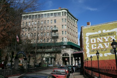
Historic Downtown of Eureka Springs
They came because of the popularity of mineral springs in those days. People believed the pure water provided cures for a variety of illnesses and the arrival of the railroad brought crowds in to enjoy the spas, hotels and other amenities of the resort community in the Ozarks.

The belief in the power of water from mineral springs diminished in the 20th century, but unlike many such places, Eureka Springs preserved its beautiful atmosphere and architecture. It stands today as one of the most beautifully preserved Victorian towns in the world. The romance of days gone by is unmistakable and the town offers beautiful historic accommodations, restaurants, shops and entertainment. Carriages roll through the streets and couples walk hand in hand along the sidewalks.

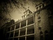
Crescent Hotel in Eureka Springs
And there are weddings. More weddings than can be imagined. There is no blood test and no waiting to get married in Eureka Springs. A couple can arrive, get their license, get married and be on their honeymoon in a beautiful historic hotel, bed and breakfast or more modern accommodation in less than 90 minutes.

An array of wedding locations are available, ranging from the simple to the elegant, or one of the town's many ministers will come to you and perform a wedding at the location of your choice. An overlook on East Mountain, for example, provides a spectacular view of the valley and Victorian town and is popular for couples looking to marry surrounded by the beauty of the mountains.

To learn more about Eureka Springs, please visit www.exploresouthernhistory.com/eurekaindex.

For complete information on getting married in Eureka Springs, please visit www.exploresouthernhistory.com/eurekaweddings.

Sunday, February 5, 2012

Historic Springs of Eureka Springs, Arkansas

Eureka Springs, Arkansas
The landscape of the South is dotted with towns and cities named after springs. There are Hot Springs, Warm Springs, Boiling Springs, Old Town Spring, Spring Hill, Winter Springs, Mineral Springs, Sylvan Springs, Holly Springs and the list goes on and on.
One of the most beloved such communities, however, is Eureka Springs. Located high in the mountains of the Ozarks, Eureka Springs is the number one wedding location per capita in the nation. More people go there to get married each year than actually live in the town.

Crescent Spring in Eureka Springs
Known for its beautiful scenery, inns, hotels, bed & breakfast inns, resorts, restaurants and unique shopping, Eureka Springs has done a marvelous job of preserving and restoring the historic springs that give the town its name.

A surprisingly large number of natural, mineral springs flow from the mountainsides surrounding the town. These springs were considered a source of health-giving mineral waters during the 19th century. Those were the days when crowds of people flooded to Eureka Springs to soak in its spring waters in hopes of finding miracle cures for physical and neurological illnesses.

Grotto Spring in Eureka Springs
The belief in the curative power of mineral springs faded in the 20th century, but Eureka Springs preserved its historic springs and today they add greatly to the charm of the beautiful Victorian community.

Probably the best known and photographed of the springs in Basin Spring, which is the centerpiece of a charming little park in the downtown area. Crescent Spring, down the mountain from the magnificent Crescent Hotel, is covered by a restored Victorian gazebo. A stone stairway leads up the mountain to the historic hotel itself.

Nearby is Grotto Spring, which flows from a natural grotto in the mountainside. History lovers also flock to Carrie Nation Spring, a natural spring that flows from the mountain across the road from the home of Carrie Nation, the famed ax-toting liquor fighter of the Prohibition era.

To learn more about Eureka Springs, its historic springs and other points of interest, please visit www.exploresouthernhistory.com/eurekaindex.

Thursday, February 2, 2012

Beauvoir in Biloxi, Mississippi - Final Home of President Jefferson Davis

Beauvoir, Final Home of Jefferson Davis
One of the most beautiful landmarks of the Mississippi Gulf Coast is the appropriately named Beauvoir, the last home of Confederate President Jefferson Davis.

The home survived the brutal winds and storm surge of Hurricane Katrina and his been restored to its pre-storm beauty. It faces across US 90 to Mississippi Sound and the Gulf of Mexico in the popular resort city of Biloxi.

Beauvoir in Biloxi, Mississippi
Built in 1848, the same year as the nearby Biloxi Lighthouse, Beauvoir originally was known as Orange Grove. Satsuma Oranges then grew in profusion on the grounds, as they once did across the entire northern Gulf Coast, giving the summer home of the James Brown family its name. Brown died in 1857 and his widow later sold the home to a real estate speculator who, in turn, sold it to Mrs. Sarah Dorsey.

Bedroom of Jefferson Davis
Mrs. Dorsey renamed the home Beauvoir (French for "Beautiful View") and in 1877 invited former Confederate President Jefferson Davis to use a pavilion on the grounds as a writing retreat. Two years later she agreed to sell the entire estate to Davis for $5,000, to be paid in three payments. Mrs. Dorsey died after receiving the first payment from Davis and the Southern leader was surprised to find that she had left Beauvoir to him in her will.

It was at Beauvoir that Davis completed his monumental work, The Rise and Fall of the Conferate Government and a shorter volume, A Short History of the Confederate States of America.

Now owned by the Mississippi Division of the Sons of Confederate Veterans, Beauvoir is open to the public daily and is a great place to explore the final years in the life of one of the most prominent Southerners of all time. The home features original furniture and other items that once belonged to the Davis family and the guides provide one of the best tours of a historic home that I've ever experienced.

To learn more about Beauvoir, please visit www.exploresouthernhistory.com/beauvoir.

Sunday, January 29, 2012

Biloxi Lighthouse - A Symbol of Mississippi Courage and Strength

Biloxi Lighthouse
The shining white tower of the Biloxi Lighthouse has survived two of the three worst hurricanes ever to hit the United States. Yet it still shines as a symbol of the courage and strength of the people of the Mississippi Gulf Coast.
Built in 1848, the tower is constructed of brick but its exterior is formed of panels of cast iron. It is, in fact, one of the few iron lighthouses in the South. It stands 45 feet tall from its foundations to the lantern room and is the only lighthouse in the United States that stands on the median of a major four-land highway (US 90).

The Biloxi Lighthouse has a remarkable history. For more than 160 years it has helped vessels navigate the shallow waters of Mississippi Sound, with only a brief interruption after it was darkened by Confederates during the Civil War. Legend holds that it was painted black as a sign of mourning when President Abraham Lincoln was assassinated, but in fact the temporary coating of black tar was done to protect the iron of the tower from rust and corrosion and not as a tribute to Lincoln.

Biloxi Lighthouse
The lighthouse in reality is a symbol of courage, strength, life and rebirth. Not only did it survive Hurricane Camille in 1969, it survived Hurricane Katrina in 2005. The latter storm hit Biloxi on August 28, 2005, with a wall of water that was more than 20 feet high. Inside the tower of the Biloxi Lighthouse, in fact, blue lines now show the depth of the water that surged across the beaches during both Camille and Katrina.

In the wake of Katrina, which destroyed 90% of the homes in Biloxi, a United States flag was draped from the lantern room of the lighthouse. It was one of those rare moments in American history when a single act inspires the people of an entire state. The lighthouse flag did just that, becoming a symbol of courage and determination for the people of Mississippi.

Biloxi and the Mississippi Gulf Coast launched one of the most determined rebuilding efforts in U.S. history. The Biloxi Lighthouse became a fixture on the state's license plates and the beautifully restored tower once again welcomes guests to one of the finest beach resorts in the South.

To learn more about the remarkable history of the Biloxi Lighthouse, please visit www.exploresouthernhistory.com/biloxilighthouse.


Saturday, January 21, 2012

Juniper Springs Recreation Area - Ocala National Forest, Florida

Juniper Springs Recreation Area
Ocala National Forest, Florida
One of the most beautiful historic sites in the nation, Juniper Springs is the centerpiece of a recreation area in Florida's Ocala National Forest.
Just 28 miles from I-75 at Ocala, Juniper Springs was one of the first recreation areas completed east of the Mississippi River by the Civilian Conservation Corps (CCC) during the Great Depression. Its original CCC features are beautifully preserved, as is the semi-tropical landscape that is unlike any other national forest recreation area in America.

Juniper Springs Recreation Area
Perhaps the most unique feature of Juniper Springs, aside from the spring itself, is the unique CCC-built millhouse. Completed in 1935-1936, this structure was the result of innovative thinking that overcame the problem of getting electricity to the park. When Juniper Springs was developed, the nearest source of electric power was then miles away. Without the money to pay for running electric lines to the recreation area, the CCC generated its own.

The charming millhouse was built at the point where the water from the spring basin flowed into Juniper Springs Run. Its undershot waterwheel powered a small generator that provided electricity for the park. The beautifully preserved millhouse is a favorite with photographers and now houses an exhibit about the development of the recreation area and the history of the CCC.

In addition to the millhouse, the park features swimming, camping, nature trails, picnicking and an access point to Juniper Springs Run, one of the most beautiful and unique canoe and kayak trails in the nation.

To learn more about scenic and historic Juniper Springs, please visit www.exploresouthernhistory.com/junipersprings.

Thursday, January 19, 2012

The Battle of Fredericksburg - Fredericksburg, Virginia

Stone wall at Sunken Road at Fredericksburg
Fredericksburg was, for the Union, one of those names that pierced the heart like the names Gettysburg and Vicksburg did for the the Confederacy. It was on the fields surrounding Fredericksburg that the Army of the Potomac suffered one of its worst defeats of the Civil War.

Key areas of the battlefield at now preserved at the Fredericksburg & Spotsylvania County Battlefields Memorial National Military Park, which also preserves areas of the Chancellorsville, Wilderness, Spotsylvania and other battlefields.
Bullet scarred house on the Fredericksburg battlefield
The Battle of Fredericksburg developed when U.S. President Abraham Lincoln named Gen. Ambrose E. Burnside to replace Gen. George B. McClellan as commander of the Army of the Potomac. While the latter general had favored a slow, methodical approach to dealing with Gen. Robert E. Lee and the Confederate Army of Nothern Virginia, Burnside proposed a rapid campaign with overwhelming force.

Inexplicably, however, Burnside pushed his army forward to the Rappahannock at Fredericksburg without making sure that his pontoon boats would be there ready for use in building bridges to cross the river. The week-long delay experienced in waiting for the pontoons to come up gave General Lee the time he needed to concentrate his on the heights overlooking Fredericksburg. By the time Burnside was ready to begin his crossing, Lee was so ready for him that, as one Confederate officer observed, a chicken couldn't have survived on the ground across which the Union soldiers would have to march.
Thousands of Union soldiers are buried at Marye's Heights
Even then, Burnside couldn't get across until after he blasted Fredericksburg with 8,000 artillery shells trying to drive away General William Barksdale's Mississippians who kept shooting his men everytime they tried to build their bridges.

Once he finally did get his army across the Rappahannock, Burnside then took another day to get his men formed for battle, while Lee and his generals watched from the heights above.

The main day of the Battle of Fredericksburg was December 13, 1862. Time after time the Union forces advanced and time after time they were driven back. At Marye's Heights, they never even got close to the Confederate infantry position at the stone wall and sunken road. By the time the day ended, the Army of the Potomac had lost over 12,000 men in killed, wounded and missing. It was one of the deadliest days of the war for the Union army.

To learn more about the Battle of Fredericksburg, please visit www.exploresouthernhistory.com/fredericksburg.

Monday, January 16, 2012

Death of "The Senator" - Florida's Largest Tree dies in Mysterious Fire

Men show the width of "The Senator" in this historic image.
Florida Memory Collection
In a stunning tragedy, a 3,500 year old cypress tree known as "The Senator" has been reduced to ash in a mysterious fire. Florida's largest tree all but vanished from the landscape in a single day.

The Orlando Sentinel reports that firefighters responded to the park in Longwood where "The Senator" was located at about 5:50 Eastern time this morning. The giant tree was found to be burning intensely and there was nothing that emergency workers could do to save it. By midday, it was gone. Only ashes and the charred stump remain to show that it ever existed at all.

The Florida Forest Service reports that the fire is not thought to have been caused by arson, but otherwise the origin of the blaze is a mystery. Additional investigation is underway.

You can read the Sentinel's full report by clicking here: http://www.orlandosentinel.com/news/local/seminole/os-senator-cypress-tree-fire-20120116,0,6171920.story.

"The Senator" as it once appeared.
Florida Memory Collection
The destruction of "The Senator" did not damage the nearby "Lady Liberty" tree, which is thought to be around 2,000 years old.

Giant cypress trees once dominated the landscape of Florida, where they had grown for thousands of years prior to the arrival of European explorers in the state. Most were felled during the timber days of the late 19th and early 20th centuries, but a few still remain.

The lifetime of "The Senator," if marked by human events, included the life of Jesus Christ, the fall of the Roman Empire, the signing of the Magna Carta, the arrival of Viking explorers in North America, the rise and decline of the Woodland and Mississippian cultures among Native Americans in Florida, the European discovery of Florida by Juan Ponce de Leon, the expedition of Hernando de Soto, the founding of St. Augustine (the first permanent city in the United States) in 1565, the founding of Jamestown in 1607, the arrival of the Pilgrims in 1620, the French and Indian War, the American Revolution, the founding of the United States, the War of 1812, the First, Second and Third Seminole Wars, the Civil War, the Spanish American War, World Wars I and II, Korea, Vietnam and millions of other significant events. Through them all, the great old cypress marked the time.  Now it is gone.

Wednesday, January 11, 2012

New book explores Murder & Mayhem in 1930s Florida

My newest book, "The Claude Neal Lynching," is now available in print or as an instant download for users of Amazon Kindle devices or Amazon's free software for your computer, iPad, etc. 

"The Claude Neal Lynching" tells the story of an outbreak of murder and mayhem in 1930s Florida that shook not just a state, but the entire nation. The chaos began on November 18, 1934, when a 19 year old woman was brutally murdered at a hog pen near the small town of Greenwood, Florida. The physical evidence pointed to a neighbor, farm worker Claude Neal, who later confessed repeatedly to the crime.

The crime was so brutal that men of the area decided Neal should not live and set out to lynch him.  Jackson County at the time, contrary to the claims of many writers, was not a hotbed of lynching. In fact, there had not been a lynching in the county for nearly 30 years. Sheriff W.F. Chambliss and his deputies tried to protect Neal, moving him to jails in Chipley, Panama City and eventually Pensacola. From there he was slipped away to the jail in Brewton, Alabama.  It was in Brewton that the lynch mob finally found him, forcing its way into the jail with pistols, shotguns and dynamite.

Neal was lynched in the swamps of Jackson County on the night of October 26, 1934, by a small group of six men. Thousands more, representing more than ten states, wanted to take part and had even gathered to do so, but were presented not with a living suspect but a dead body.  They went on a rampage, carrying Neal's body to the county seat of Marianna and hanging it from a tree on the courthouse square.

The building chaos turned into a full-fledged riot as local authorities tried to defend citizens and carry out their duty.  Even a Florida Supreme Court justice became involved, boldly stepping out through the courthouse doors even as the rioting mob was preparing to knock them down with a battering ram. With no weapon other than his powerful voice, he drove back the mob and saved the lives of the men inside the building.

National Guard troops were sent in, as newsreel cameras rolled, and positioned machine guns on all four corners of the courthouse square. The sheriff had to be protected by armed soldiers and troops also stood guard at funerals and court proceedings.  It was one of the most chaotic events in the history of any small town in America.

The events of October 1934 have been misunderstood for years and, while the lynching and riot have been discussed in more than 3,000 books, not a single one has even correctly spelled Lola Cannady's name.

"The Claude Neal Lynching" is a chronological history of an outbreak, written by a resident of the county where it happened.  It includes never before discussed evidence, interviews with participants in the lynching about how and why they did what they did, and more.  I hope you will consider it.

To order the book through Amazon, please follow this link: 
The Claude Neal Lynching: The 1934 Murders of Claude Neal and Lola Cannady

Amazon Kindle is available by clicking here:  The Claude Neal Lynching

Chancellorsville - Scene of Stonewall Jackson's Final Battle


Chancellorsville Battlefield
Just seven miles off I-95 between Richmond, Virginia, and Washington, D.C., the National Park Service preserves a spot in an old road where famed Confederate general Thomas J. "Stonewall" Jackson was severely wounded in a friendly fire incident.

The Battle of Chancellorsville may well have been the most brilliant success of Jackson's military career. With a force of 30,000 men, he hit the right flank of the massive 120,000 man Army of the Potomac, delivering a shock that would lead the following day to one of the most embarrassing Union defeats of the entire Civil War.

Jackson's flank attack was a key element of General Robert E. Lee's stunning victory over the huge army of Union general Joseph "Fighting Joe" Hooker. Together the two generals used intelligence from Southern cavalry commander General "Jeb" Stuart to develope a plan that was wildly successful. Stuart had discovered that the right flank of the Army of the Potomac was "in the air" and vulnerable to attack. Lee and Jackson agreed that the latter officer should try to sweep around that flank and roll up the Union army.


Jackson
Jackson's maneuver succeeded and he hit the very end of the Union lines late on the afternoon of May 2, 1863. The attack shocked the entire Federal army. Late in the day, with darkness and the smoke of battle obscuring visibility, Stonewall Jackson rode forward with his staff to examine the placement of the Union troops trying to resist his attacks. As he returned to his own lines, he was mistaken for the enemy and his own troops opened fire. The noted Confederate general toppled from the saddle, severely wounded. He died eight days later.


Jackson Monument
"Jeb" Stuart took command of Jackson's wing of the army and joined Lee in a smashing attack the next day that sent Hooker retreating across the Rappahannock River.

Key areas of the Chancellorsville Battlefield, including the site where Stonewall Jackson was wounded, are now part of of the Fredericksburg and Spotsylvania County Battlefields Memorial National Military Park.

To learn more, please visit www.exploresouthernhistory.com/chancellorsville.

Tuesday, December 27, 2011

The Battle of San Jacinto - LaPorte, Texas

San Jacinto Battleground
Photo Courtesy of Moore Archeological Consulting
The Battle of San Jacinto was a history-changing engagement fought on the outskirts of what is now the mega-city of Houston, Texas.
Texas had declared its independence of Mexico after the government of that country issued a racial edict prohibiting any further Anglos from emigrating to previously approved colonies in the province. Armed forces of both Texians and Tejanos had driven Mexican troops from Texas in 1835, but 1836 brought a brutal counter campaign led by General Antonio Lopez de Santa Anna.

Santa Anna styled himself the "Napoleon of the West" and stormed north across the desert, driving his army through winter conditions to appear in San Antonio in February. He took the Alamo, putting its garrison to the sword, and then ordered the slaughter of an even larger group of men that surrendered at Goliad.

Entrance to San Jacinto Battleground
Photo Courtesy of Moore Archeological Consulting
Knowing he could not hope to stand against Santa Anna with the force at his disposal, Texas general Sam Houston began a strategic retreat up the coast of the newly declared republic, scorching the earth as he went. Civilians fled for their lives as the Mexican armies advanced, many escaping with little more than the clothes on their backs. The retreat is remembered in Texas to this day as the "Runaway Scrape."

Everything changed on April 17, 1836. Having reached a site within today's location of the city that bears his name, Houston ended his retreat. Instead of taking a road that would lead him on to the Louisiana border and the protection of the U.S. Army assembled there, he instead turned down the San Jacinto River.

Prairie across which Houston Attacked
Photo Courtesy of Moore Archeological Consulting
By this time Houston, once a U.S. Army officer and the former Governor of Tennessee, had been reinforced and supplied. The strength of his army had also been augmented by the arrival of two small cannon. Dubbed the "Twin Sisters," these guns had been sent as a gift by the citizens of Cincinnati, Ohio.

In the days that followed, Houston took up a position near the confluence of Buffalo Bayou and the San Jacinto River, placing both streams to his rear as a clear signal to his men that there would be no retreat. Santa Anna advanced and assembled his army across a marshy prairie from Houston's men.

Although the Mexican general had the larger army and better artillery, it was Houston that seized the initiative. Sending mounted men to burn a bridge to Santa Anna's rear, he formed his men to battle with shouts of "Remember the Alamo!"

The Battle of San Jacinto lasted less than 30 minutes, but ended with Texas having assured its status as an independent republic. Santa Anna lost 630 men killed, 208 wounded and 730 captured. Houston lost a total of 39.

To learn more about the battle and to see more photos of the battleground, please visit www.exploresouthernhistory.com/sanjacinto.

Sunday, November 27, 2011

Gold Rush in the North Georgia Mountains!

Dahlonega Gold Museum
With the holiday season now here, the ideal place to look for a nice piece of gold this year might be a stream in the North Georgia mountains!
It is a little known fact that 20 years before the California Gold Rush of 1849, the mountains of Georgia were the scene of America's first major gold rush. Residents of the area around what is now Dahlonega called it the "gold fever" and within just months of the discovery of the first nugget, thousands of men made their way in from all over the United States to search for the elusive yellow metal.

There was so much gold in the North Georgia mountains that Dahlonega was made the site of a U.S. Branch Mint by Congress. Between 1838 and 1861, the mint there turned out $6,000,000 in gold coins. And the face value of those coins was based on the early 19th century evaluation of gold!

Panning for Gold in North Georgia
USFS Photo
The gold rush began in the winter of 1828-1829 when a bit of gold was found in an area about 30 miles north of the Georgia town of Gainesville. This was the area that is now part of Lumpkin County and in the vicinity of the soon to rise boomtowns of Dahlonega and Auraria.

Within just three years after the discovery, an estimated $212,000 in gold was brought out of the North Georgia mountains (in 1831 dollars!). Based on the current prices, that amount of gold today would be worth $18,586,900.

Gold Stream in North Georgia
By 1831, Georgia was America's top gold producing state. The boom days continued until 1849, when news spread east of the strike at Sutter's Mill in California. The departure of so many miners for the west prompted concerns at the U.S. Branch Mint in Dahlonega. Dr. Matthew Stephenson, an assayer for the mint, took to the steps of the Lumpkin County Courthouse (now the Dahlonega Gold Museum) to urge miners to stay.  Pointing at surrounding ridges, he correctly prophesied that millions of dollars in gold remained to be found there.  It is said that he was the first person to use the now well-known phrase, "There's gold in them there hills!"

There is still gold in those hills. As gold prices have soared over the last few years, a whole new generation has begun panning the streams of North Georgia.

To learn more, please visit www.exploresouthernhistory.com/georgiagold.

While there, be sure to follow the links at the bottom of the page to Dahlonega, the Dahlonega Gold Museum and the U.S. Branch Mint at Dahlonega.

Thursday, November 17, 2011

Ichetucknee Springs State Park - Fort White, Florida

Head Spring at Ichetucknee Springs State Park
While most people head to the mountains in search of fall color, Florida offers a chance to see fall and winter color of a different kind!
Take Ichetucknee Springs State Park, for example. Located at Fort White the park is only 20 minutes from I-75 at Lake City. The blue color of its water on sunny fall days is absolutely remarkable.

Ichetucknee Springs (the name is said to be an Indian word meaning something like "place of the otters") is actually a group of seven large springs that are among the most remarkable in the world. They pour out an astounding 85 billion gallons of crystal clear water each year, straight up from the Floridan Aquifer.

Interpretive Panel at Ichetucknee Springs
Fall and winter is actually a great time to visit the park because the swarms of people that flood there to swim, tube and canoe during the summer tend to vanish after Labor Day.  When I stopped by Ichetucknee in late October, I saw only two other people the entire time I was there.  If you like peace and quiet and scenic beauty, now is the time to go.

The springs are also rich in history. Hernando de Soto passed through the area in 1539, taking a Timucuan Indian chief and his daughter hostage and forcing many of their followers into slavery.

Clear Blue Water at Ichetucknee Springs
In 1608 the Mission San Martin de Timucua was established at Fig or Mission Springs in the park. Consisting of a church, convento (friar's home), plaza and cemetery, it was associated with a large village of Timucuans.  The Franciscan friars worked at Mission San Martin until 1656, converting many of the villagers to Christianity, before the mission was destroyed in an uprising by its inhabitants.

In later years Florida's famed Bellamy or Pensacola to St. Augustine Road passed by the springs and they were a popular stopping point for visitors making their way through the wilderness of Territorial Florida.

To learn more about the history and natural beauty of Ichetucknee Springs, please visit www.exploresouthernhistory.com/ichetuckneesprings.

Saturday, November 5, 2011

National Naval Aviation Museum & 100 Years of Naval Aviation

World War II Aircraft
2011 marks the 100th anniversary of the year that the U.S. Navy first took to the air.  That entire span of history can be viewed at the outstanding National Naval Aviation Museum in Pensacola, Florida.
Located on board Naval Air Station, Pensacola, the museum preserves aircraft and artifacts from all eras of Naval Aviation. Exhibits range from displays of the earliest types of aircraft flown by the U.S. Navy to the reconstructed deck of an aircraft carrier to artifacts from the exploration of space. It is a little known fact that the first American in space, Alan B. Shepard, was a naval aviator.

Jet Fighters
The museum offers a chance for visitors to get up close to some of the most powerful weapons of war ever created. Fighter planes from all eras of the 20th century are on display, along with trainers and other aircraft. From jet fighters that saw service around the world to World War II planes recovered from the deep and even the biplane trainer flown by President George H.W. Bush, the aircraft displays are remarkable and fascinating.

Visitors to the National Naval Aviation Museum can also experience what it is like to fly in some of the U.S. Navy's top aircraft thanks to MaxFlight 360 flight simulators. These remarkable simulators offer the chance to "fly" in 3D and feel what it is like to be in air to air combat.

The museum also preserves and displays artifacts and exhibits that tell the stories of heroism exhibited by some of America's finest pilots and crews in conflicts including World War I, World War II, Korea, Vietnam and the Middle East campaigns.

To learn more, please visit www.exploresouthernhistory.com/navalaviationmuseum.

Saturday, October 29, 2011

Halloween Weekend - Looking for good, historically-based, Ghost Stories??

Crescent Hotel - America's Most Haunted?
Halloween weekend is here!  And while many people enjoy trick or treating, costumes  and fake but scary haunted houses, others like to read or share "real" ghost stories.

At www.exploresouthernhistory.com we focus exclusively on stories that have a verifiable historical background. Not only that, we dig into stories to find out as best we can what the truth behind them might be!

You can check out the full list at www.exploresouthernhistory.com/ghost1, but here are some of our favorites:

Just use your back button to come back to this list!

Sunday, October 23, 2011

The Claude Neal Lynching: FBI investigating 77 year old Florida crime

Edited Photo of Claude Neal Lynching
The U.S. Department of Justice has opened a new investigation into the notorious 1934 lynching of Claude Neal near Marianna, Florida.

FBI agents have been looking at archival records and interviewing family members of Neal as well as public officials in Jackson County, where the lynching took place. The Justice Department neither confirms nor denies such investigations, but has said that it is looking into nearly 100 such cases as part of a new focus on unsolved crimes of the Civil Rights era. Officials in Marianna, speaking off the record, confirmed that they have talked with the FBI about the case.

Claude Neal was a 23 year old black farm laborer in Jackson County at the time of the lynching. The series of events leading to his death began on October 18, 1934, when a 19 year old woman named Lola Cannady left her home in a rural area and walked a few hundred yards across an open field to water her family's hogs. She never came back.

Location of Lola Cannady Murder, 1980s
As concern over her disappearance grew, family members and neighbors started to search the surrounding fields and woods. Near the hand pump at the hog pen they found indications of a large fight. Footprints went around and around in circles and there were blood splatters on the ground. They also found a man's footprints leading from the scene across a field to a nearby home.

When they followed the prints to the house, they found two women - Sallie and Annie Smith - trying to wash blood from a man's clothes. Annie's son, Claude Neal, was not home and would not return home that night. A bloody hammer was also found at the house.  The women would soon admit that the clothes belonged to Neal and Annie Smith would tell Sheriff W.F. "Flake" Chambliss that she had seen Neal and Cannady near the hog pen and had heard her screams.

Lola's mother looking at her daughter's body, 1934.
Lola's body was found in a wooded area the next morning. She had been raped and beaten to death. A blood-stained piece of cloth was found near her body. It matched a piece that had been torn from the sleeve of Claude Neal's shirt. Searchers also found the stem and loop of a pocket watch at the scene. When he was arrested that day, Neal was carrying a pocket watch but deputies quickly noted that it was missing its stem and loop. The watch parts found near Lola's body fit perfectly onto the broken part of Claude's watch.

The Jackson County sheriff tried to protect Neal from a growing mob that was determined to exact revenge on him by taking him from authorities and turning him over to Lola's father. The suspect was moved to jails in Chipley, Panama City and Pensacola, Florida, before finally being moved to a double-locked cell at the jail in Brewton, Alabama.  He was taken from the latter place by mob members armed with shotguns, pistols and sticks of dynamite.

National Guard troops from company sent to Marianna.
Claude Neal was carried back to Jackson County where he was tortured and then killed by a small group of six men who held him in the woods near a riverboat landing on the Chattahoochee River. His body was then carried to the Cannady farm and from there it was taken to Marianna and hanged from a tree on courthouse square.

Marianna was the scene of rioting on the day the body was found at the courthouse and Florida Governor Dave Sholtz had to send in two companies of the Florida National Guard to calm the situation.

The Claude Neal lynching became a focal part of an effort by the NAACP and other groups to secure the passage of a national anti-lynching law. The men that killed Neal were never tried and all are now dead. The shadow of the lynching, however, lingers even today as an important part of both the history and present of Florida.

To learn more and see a new online video on the case, please visit www.exploresouthernhistory.com/claudeneal.


Friday, October 7, 2011

Best Autumn Drives #5 - Highway 190 in Franklin D. Roosevelt State Park, Georgia

Overlook at Franklin D. Roosevelt State Park
Highway 190, which passes along the crest of Pine Mountain through the full length of Franklin D. Roosevelt State Park in Georgia, is one of the most beautiful fall drives in the South.
The park takes its name from the President that led the United States through the dark days of the Great Depression and World War II. In fact, President Roosevelt died at his Little White House near Warm Springs on the northern slopes of Pine Mountain. He frequented the beautiful scenery now included in the more than 9,000 acres of the state park.

Highway 190 enters the park at the Callaway Store and Overlook just north of Hamilton, Georgia. From there it winds its way along the top of the mountain, past overlooks, the park office, cabins, picnic areas, trail heads and other points of interest until it exits the park just outside Warm Springs. The total length is just under 12 miles.

Roosevelt Statue at Dowdell's Knob
Along the way, be sure to take Dowdell Knob Road out to Dowdell's Knob, a favorite picnic spot of President Roosevelt. The knob is a hilltop that projects from the side of the mountain and provides a spectacular, panoramic view of the surrounding countryside.  During the fall it overlooks an amazing natural canvas of color, especially reds and golds.

Highway 190 itself is simply a spectacular drive in years when the leaves are good.  Along much of the route, the trees form natural arches over the roadway. When these take on their full color, the scene as you pass through the trees is simply amazing.

The drive is also just minutes away from Pine Mountain's famed Callaway Gardens, which also offers spectacular fall scenery.  The grounds of the Little White House near the northern end of the highway are also beautiful in the fall.

If you want to enjoy a great lunch while visiting Pine Mountain, consider the Callaway Country Store located at the southern entrance to the state park. The dining room there has what may be the best fried chicken in Georgia and features spectacular views from your table.  You can also take a picnic and enjoy the mountain scenery itself as there are plenty of great picnic spots along the road and the weather is usually mild, but cool (be sure to take a sweater or jacket).

To learn more about Franklin D. Roosevelt State Park, please visit www.exploresouthernhistory.com/fdrstatepark.

You can also check out the views from Dowdell's Knob at www.exploresouthernhistory.com/dowdellsknob.

You can read about the Little White House and President Roosevelt at www.exploresouthernhistory.com/littlewhitehouse.

And, last but not least, read about Callaway Gardens at www.exploresouthernhistory.com/callawaygardens1.

Tuesday, October 4, 2011

Best Autumn Drives #4 - Cheaha State Park Loop, Alabama

View from Cheaha State Park Restaurant
Alabama's highest point is a spectacular destination year round, but the top of Cheaha Mountain (or Mt. Cheaha as it is commonly known) turns into a stunning wonderland of color during the annual fall leaf change.
Bunker Loop is a paved drive that takes visitors around the top of the mountain. Beginning at the park entrance on Highway 281 (Talladega Scenic Drive), it winds its way around the main plateau atop the mountain and offers beautiful scenery and numerous points of interest.

Bald Rock Overlook
Among the stops of note along the loop is Bunker Tower, a beautiful stone structure built by the Civilian Conservation Corps (CCC) back in the 1930s that rises high into the clear mountain air from the peak of Alabama's tallest point. From the top visitors can take in a remarkable 360 degree view of Cheaha and the surrounding Talladega National Forest.

Just up the loop from the tower is the parking area for the Doug Ghee Accessible Trail to Bald Rock. A very nice boardwalk is accessible for visitors of all abilities, the trail leads to an overlook atop Bald Rock on the edge of the mountain. The view is stunning and in the fall an array of color stretches for as far as the eye can see.

Also accessible off the loop is the trail to Pulpit Rock. A rugged walk through rock fields and down a steep slope, the trail ends at a stunning rock that juts out from the side of the mountain.

Cheaha State Park also offers a wide array of amenities, ranging from a hotel to cabins and campgrounds to a mountaintop restaurant with perhaps the best view of any place to eat in Alabama.

To learn more about the park, please visit www.exploresouthernhistory.com/cheaha1.

Saturday, October 1, 2011

Best Autumn Drives #3 - Pig Trail Scenic Byway, Arkansas

Ozark Mountains of Arkansas
Continuing our look (not in any particular order) of some of the best autumn drives in the South, this post focuses on the famed Pig Trail Scenic Byway in Arkansas.
So named because it is used as a short cut by many fans on their way to University of Arkansas Razorbacks football games on weekends in the fall, the Pig Trail passes through some of the prettiest scenery in the Ozarks.

The Pig Trail actually originated as a winding trail that provided foot access for ancient Indian hunters as they made their way into the mountains of the Ozarks from the Arkansas River Valley. When French hunters and trappers arrived in Arkansas during the 1600s, they discovered this path and used it as well. In fact, they gave the name Aux Arcs (which has been corrupted in English to "Ozarks") to the wide bend of the river at the point it is intersected by the trail. This is now the site of the town of Ozark.

Pig Trail Scenic Byway
In later years, the trail was used by early settlers of the mountains and later by Union and Confederate soldiers, as well as the riders of the vicious guerrilla bands that infested the region, during the Civil War.

The mountains surrounding the Pig Trail became part of the Ozark National Forest when it was established in the early 1900s and over the years the road became a favorite way to access the mountains and the beautiful Mulberry River area. The National Forest Service designated it as a scenic byway and today it provides a way for visitors to explore a stunning area of mountains, valleys, wild rivers and waterfalls.

To learn more about the Pig Trail Scenic Byway, please follow this link: http://www.exploresouthernhistory.com/pigtrail.html.