|
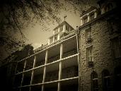
| San Jacinto Battleground Photo Courtesy of Moore Archeological Consulting |
Texas had declared its independence of Mexico after the government of that country issued a racial edict prohibiting any further Anglos from emigrating to previously approved colonies in the province. Armed forces of both Texians and Tejanos had driven Mexican troops from Texas in 1835, but 1836 brought a brutal counter campaign led by General Antonio Lopez de Santa Anna.
Santa Anna styled himself the "Napoleon of the West" and stormed north across the desert, driving his army through winter conditions to appear in San Antonio in February. He took the Alamo, putting its garrison to the sword, and then ordered the slaughter of an even larger group of men that surrendered at Goliad.
 |
| Entrance to San Jacinto Battleground Photo Courtesy of Moore Archeological Consulting |
Everything changed on April 17, 1836. Having reached a site within today's location of the city that bears his name, Houston ended his retreat. Instead of taking a road that would lead him on to the Louisiana border and the protection of the U.S. Army assembled there, he instead turned down the San Jacinto River.
 |
| Prairie across which Houston Attacked Photo Courtesy of Moore Archeological Consulting |
In the days that followed, Houston took up a position near the confluence of Buffalo Bayou and the San Jacinto River, placing both streams to his rear as a clear signal to his men that there would be no retreat. Santa Anna advanced and assembled his army across a marshy prairie from Houston's men.
Although the Mexican general had the larger army and better artillery, it was Houston that seized the initiative. Sending mounted men to burn a bridge to Santa Anna's rear, he formed his men to battle with shouts of "Remember the Alamo!"
The Battle of San Jacinto lasted less than 30 minutes, but ended with Texas having assured its status as an independent republic. Santa Anna lost 630 men killed, 208 wounded and 730 captured. Houston lost a total of 39.
To learn more about the battle and to see more photos of the battleground, please visit www.exploresouthernhistory.com/sanjacinto.