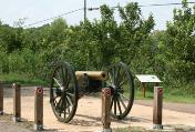
Mount Locust, located atop a hill at the 15.5 mile marker of the Natchez Trace Parkway, is one of the most important historic sites along the 444 mile long National Park area.
Built in 1780, while the American Revolution was still in full fury, the historic home originally served as an inn or "stand" along the famed Natchez Trace. This roadway led from Natchez, Mississippi, to Nashville, Tennessee, and provided a short cut for "Kaintuck" boatmen who floated cargoes of furs and farm products down the Mississippi River to Natchez and New Orleans. Steamboat travel had not yet been developed, so getting back home to upriver settlements in the Ohio, Cumberland and Tennessee valleys wasn't quite as easy as getting downstream. The solution was the Natchez Trace. Sometimes called America's first "superhighway," it was an overland path by which the boatmen could make their way back home.
In those days fifteen miles was about the distance that a person could be expected to walk in a day, so resting places naturally developed in intervals of about that length. Mount Locust was just over fifteen miles north of Natchez and offered food and sleeping space to weary travelers for 25 cents a day.
In later years, when travel on the Trace was replaced by steamboats on the Mississippi, the house became the center of a large Mississippi cotton plantation. When the Natchez Trace Parkway was developed, however, the park service acquired the house and grounds for development as a historic site.
The unique old home, which far pre-dates the state of Mississippi, has been restored to its 1820 appearance and is in a remarkable state of preservation. To learn more, please visit www.exploresouthernhistory.com/natchezlocust.
This blog is devoted to exploring the history, historic sites and heritage tourism opportunities of the American South! A guide to new additions and updates to the expansive site www.exploresouthernhistory.com, this blog features forts, battlefields, Native American sites, architectural treasures and natural wonders.
Thursday, July 15, 2010
Saturday, July 10, 2010
Ghost Face in the Window - Carrollton, Alabama
If a window in the historic Pickens County Courthouse in Carrollton, Alabama, really holds what legend says it does, it could be one of the most unusual historic sites in the nation.
The famous Face in the Window (also called the Ghost in the Window) is a strange face that can be seen in the glass of the window when viewed from the street below. From inside the courthouse, nothing can be seen. Science (and some historical researchers) say it can't be what it is purported to be, but the fact remains that the face is there.
Local legend holds that former slave named Henry Wells burned down the second Pickens County Courthouse not long after it was rebuilt following a torching by Union troops during the Civil War. It took two years to arrest Wells for the crime, but by 1868 he was in custody and had confessed to his role in the arson. Either due to an escape attempt or prior to his capture, he was supposely hiding in the attic of the newly completed third courthouse when lightning struck the window in question as he looked out into a storm. As the story goes, the combination of electricity, water and glass left a perfect photograph of the man on the window.
Scientists argue that this is not physically possible, but who can really say what the power of a massive bolt of lightning might be. In fact, there are several other instances of alleged lightning portrats, including one from another Alabama location during the same location.
Over time the Face in the Window has faded, but a close look still reveals a shape in the glass that has a distinct human-like appearance. Many have been prompted to remark that Henry Wells may still be staring from the window all these years later. The tale has become one of Alabama's most famous ghost stories and was featured in Kathryn Tucker Windham's popular book, 13 Alabama Ghosts and Jeffrey.
To read the story and learn more about the Face in the Window, please visit www.exploresouthernhistory.com/faceinthewindow.
The famous Face in the Window (also called the Ghost in the Window) is a strange face that can be seen in the glass of the window when viewed from the street below. From inside the courthouse, nothing can be seen. Science (and some historical researchers) say it can't be what it is purported to be, but the fact remains that the face is there.
Local legend holds that former slave named Henry Wells burned down the second Pickens County Courthouse not long after it was rebuilt following a torching by Union troops during the Civil War. It took two years to arrest Wells for the crime, but by 1868 he was in custody and had confessed to his role in the arson. Either due to an escape attempt or prior to his capture, he was supposely hiding in the attic of the newly completed third courthouse when lightning struck the window in question as he looked out into a storm. As the story goes, the combination of electricity, water and glass left a perfect photograph of the man on the window.
Scientists argue that this is not physically possible, but who can really say what the power of a massive bolt of lightning might be. In fact, there are several other instances of alleged lightning portrats, including one from another Alabama location during the same location.
Over time the Face in the Window has faded, but a close look still reveals a shape in the glass that has a distinct human-like appearance. Many have been prompted to remark that Henry Wells may still be staring from the window all these years later. The tale has become one of Alabama's most famous ghost stories and was featured in Kathryn Tucker Windham's popular book, 13 Alabama Ghosts and Jeffrey.
To read the story and learn more about the Face in the Window, please visit www.exploresouthernhistory.com/faceinthewindow.
Sunday, June 27, 2010
Homosassa Springs Wildlife State Park - Homosassa Springs, Florida
The manatee of the Florida Gulf Coast have become a favorite attraction for visitors to the Sunshine State. They can be found from the Big Bend south to the Keys, but perhaps the best place to see them up close and personal without even getting your feet wet is Homosassa Springs Wildlife State Park.
Located 60 miles north of Tampa and 90 miles northwest of Orlando on U.S. Highway 19, the spring has been a tourist attraction for so long that it holds a unique place in Florida history as a result. Beginning in around 1900, trains ran along what is now Fish Bowl Drive, a street that passes through the park. The trains would stop at Homosassa Springs to let passengers rest by the spring. Slowly it developed into a popular attraction.
In the 1930s it was home to a hunting lodge owned by baseball legend Dazzy Vance. In the 1960s a company that trained animals for use in Hollywood movies and television shows located there. Visitors could even meet Buck the Bear, who doubled for "Gentle Ben" in the popular tv show of that name.
Today Homosassa Springs is a state park, noted for its pristine beauty and crystal clear water. Six manatee call the spring home and can be seen there 365 days a year. The park also cares for other manatee that are recuperating from injuries or illness until they can be returned to the wild. Visitors can watch them swimming in the spring or even walk down a stairway into an underwater observation room to see them from a fish eye view.
Homosassa Springs Wildlife State Park is also home to Lu the Hippo. He holds the distinction of being the only hippopotamus who has been declared an official resident of the State of Florida. To learn his story and more, please visit www.exploresouthernhsitory.com./homosassa.
Located 60 miles north of Tampa and 90 miles northwest of Orlando on U.S. Highway 19, the spring has been a tourist attraction for so long that it holds a unique place in Florida history as a result. Beginning in around 1900, trains ran along what is now Fish Bowl Drive, a street that passes through the park. The trains would stop at Homosassa Springs to let passengers rest by the spring. Slowly it developed into a popular attraction.
In the 1930s it was home to a hunting lodge owned by baseball legend Dazzy Vance. In the 1960s a company that trained animals for use in Hollywood movies and television shows located there. Visitors could even meet Buck the Bear, who doubled for "Gentle Ben" in the popular tv show of that name.
Today Homosassa Springs is a state park, noted for its pristine beauty and crystal clear water. Six manatee call the spring home and can be seen there 365 days a year. The park also cares for other manatee that are recuperating from injuries or illness until they can be returned to the wild. Visitors can watch them swimming in the spring or even walk down a stairway into an underwater observation room to see them from a fish eye view.
Homosassa Springs Wildlife State Park is also home to Lu the Hippo. He holds the distinction of being the only hippopotamus who has been declared an official resident of the State of Florida. To learn his story and more, please visit www.exploresouthernhsitory.com./homosassa.
Thursday, June 24, 2010
Swann Covered Bridge - Blount County, Alabama
The longest surviving covered bridge in Alabama presents a spectacular scene as it stretches over the gorge of the Locust Fork of the Warrior River.
Built in 1933 by the uncle and nephew team of Zelmer and Forrest Tidwell, the Swann Covered Bridge is listed on the National Register of Historic Places and is one of three surviving covered bridges in Blount County, Alabama.
These beautiful old bridges stand as silent reminders of the days before concrete and steel were commonly used in bridge construction. Because the wood flooring of bridges often deteriorated rapidly due to exposure to the elements such as rain, snow and ice, our ancestors came up with the idea of building covers over bridges to protect the flooring. For many years covered bridges were common on the roads and byways of America, but today most have long since disappeared.
In Alabama, there were once more than 30 covered bridges, but only 11 survive. Sadly, several have been lost in recent years due to vandalism and arson.
Fortunately, the beautiful Swann bridge is among those that survive. More than 300 feet long, it is a three span bridge with the main spain stretching for more than 75 feet over the rushing water of the Locust Fork.
To learn more about this beautiful old bridge, please visit www.exploresouthernhistory.com/swann.
Built in 1933 by the uncle and nephew team of Zelmer and Forrest Tidwell, the Swann Covered Bridge is listed on the National Register of Historic Places and is one of three surviving covered bridges in Blount County, Alabama.
These beautiful old bridges stand as silent reminders of the days before concrete and steel were commonly used in bridge construction. Because the wood flooring of bridges often deteriorated rapidly due to exposure to the elements such as rain, snow and ice, our ancestors came up with the idea of building covers over bridges to protect the flooring. For many years covered bridges were common on the roads and byways of America, but today most have long since disappeared.
In Alabama, there were once more than 30 covered bridges, but only 11 survive. Sadly, several have been lost in recent years due to vandalism and arson.
Fortunately, the beautiful Swann bridge is among those that survive. More than 300 feet long, it is a three span bridge with the main spain stretching for more than 75 feet over the rushing water of the Locust Fork.
To learn more about this beautiful old bridge, please visit www.exploresouthernhistory.com/swann.
Labels:
alabama,
blount county,
covered bridge,
swann covered bridge
Monday, June 21, 2010
Belle Grove Historic District - Fort Smith, Arkansas
One of the most charming historic districts in the South can actually be found on what was once its western frontier.
Belle Grove Historic District in Fort Smith, Arkansas, coverd 22 city blocks and features an array of stunning historic structures spanning 130 years of Southern history. The numerous architectural styles on display in the district clearly demonstrate the city's historical claim to be the place "Where the Old South meets the Old West."
The John Rogers House, built in 1840 and thought to be the oldest house in Fort Smith, was patterned after the barracks of the old fort itself. Like many other homes in Belle Grove, it survived the violent years of the Civil War in the West and stands today as a landmark of Fort Smith's early history.
Nearby stands the unique Casper Reutzel House. Built using a half-timber and brick nogging design, it was completed in 1850 and was the home of Reutzel, who ran the most successful cotton shipping business on the Arkansas River. Another survivor of the Civil War, the house was loopholed for musketry.
Other structures in the Belle Grove Historic District include the Fort Smith Art Center (built in 1857 and used to quarter troops during the Civil War), the Bonneville House (built in 1870 and purchased in 1878 by the widow of Gen. Benjamin Bonneville, a famous Western explorer), the Clayton House (once the home of the District Attorney during the days of "Hanging Judge" Isaac C. Parker) and the Darby House (the boyhood home of Gen. William O. Darby, the father of the U.S. Army Rangers).
To learn more, please visit www.exploresouthernhistory.com/fsbellegrove.
Sunday, June 20, 2010
Jimmy Buffett announces plans for Free Concert to help Gulf Coast
Jimmy Buffett has announced that he will hold a free concert "on the beach" at Gulf Shores, Alabama, on July 1 to encourage people to visit the Gulf Coast despite the Oil Spill.
The concert will air live on CMT at 7 p.m. central and will also feature Kenny Chesney, Sonny Landreth, the Zac Brown Band and others. CMT indicates in a statement today that additional plans will be announced over the coming days.
Please click here to read the announcement at Buffett's website, Margaritaville.com.
The concert will air live on CMT at 7 p.m. central and will also feature Kenny Chesney, Sonny Landreth, the Zac Brown Band and others. CMT indicates in a statement today that additional plans will be announced over the coming days.
Please click here to read the announcement at Buffett's website, Margaritaville.com.
Labels:
alabama,
gulf shores,
jimmy buffett,
oil spill
Oak Mountain State Park & Peavine Falls - Pelham, Alabama
On the southern edge of Birmingham in Pelham, Alabama's beautiful Oak Mountain State Park spreads out over nearly 10,000 acres of pristine and historic mountain country.
Situated in Shelby County, an area rich in historic sites, the popular state park is a great place to explore the natural history of Alabama. With over 50 miles of hiking trails that lead up and down mountain ridges as well as a paved drive leading up to picnic tables and overlooks high atop the mountain, the expansive park is perfect for exploring the outdoors and learning more about the birds and wildlife of the state.

The Alabama Wildlife Center, located at Oak Mountain State Park, is the oldest and largest animal rehabilitation center in the state. Each year its staff and volunteers care for over 2,500 injured wild animals. The center is open to the public, as is the Treetop Nature Trail, an elevated boardwalk that allows up close and personal views of Alabama birdlife including Great Barn Owls, hawks and more.
One of the most popular points of interest in the park is Peavine Falls, a beautiful waterfall formed by a 60-foot cascade down the mountainside. Accessible from several hiking trails, the falls run best in rainy weather and were one of the first major attractions at Oak Mountain. The Civilian Conservation Corps (CCC) opened a trail to the waterfall when the park was under the development during the Great Depression.
To learn more about the history and points of interest at Oak Mountain State Park, please visit www.exploresouthernhistory.com/oakmountain.
Situated in Shelby County, an area rich in historic sites, the popular state park is a great place to explore the natural history of Alabama. With over 50 miles of hiking trails that lead up and down mountain ridges as well as a paved drive leading up to picnic tables and overlooks high atop the mountain, the expansive park is perfect for exploring the outdoors and learning more about the birds and wildlife of the state.

The Alabama Wildlife Center, located at Oak Mountain State Park, is the oldest and largest animal rehabilitation center in the state. Each year its staff and volunteers care for over 2,500 injured wild animals. The center is open to the public, as is the Treetop Nature Trail, an elevated boardwalk that allows up close and personal views of Alabama birdlife including Great Barn Owls, hawks and more.
One of the most popular points of interest in the park is Peavine Falls, a beautiful waterfall formed by a 60-foot cascade down the mountainside. Accessible from several hiking trails, the falls run best in rainy weather and were one of the first major attractions at Oak Mountain. The Civilian Conservation Corps (CCC) opened a trail to the waterfall when the park was under the development during the Great Depression.
To learn more about the history and points of interest at Oak Mountain State Park, please visit www.exploresouthernhistory.com/oakmountain.
Labels:
alabama,
birmingham,
oak mountain,
peavine falls,
pelham,
shelby county,
state park,
waterfall
Friday, June 18, 2010
Battle of Booneville - Booneville, Mississippi
On July 1, 1862, Confederate cavalry forces led by General James R. Chalmers attacked Union cavalry forces at Booneville, Mississippi. The battle that followed would lead to widespread acclaim in the North for Colonel "Little" Phil Sheridan and in part to his promotion to brigadier general.
As the story was told in the North, Sheridan was camped at Booneville with two regiments of Union cavalry, the Second Michigan and Second Iowa. On the morning of July 1, 1862, Confederate troops drove in his pickets on the outskirts of town and a full scale battle quickly developed. The Federals were initially driven back, but Sheridan saved the day by carrying out simultaneous attacks on both the Confederate flank and rear.
This much of the story is true, but word quickly spread that with only 700 or so men, Sheridan had stood down a devastating attack by from 4000 to 5000 Confederates. Not only was he credited with holding back the Southern attack, but the force at the colonel's command claimed to have killed 65 Confederates while losing only one man killed.
It was the story that made Sheridan a hero in the North and started him on the road that would lead to a careeer as one of the most determined and successful Union generals. The problem is that it might not be entirely true.
A report by Confederate General Braxton Bragg prior to the battle indicates that General Chalmers commanded a cavalry force of only 1,200 to 1,500 men, not the 4,000 - 5,000 claimed by Sheridan. Chalmers himself wrote that he sent only three regiments - the First Confederate Cavalry, the First Alabama cavalry and Wirt Adams' regiment from Mississippi - into the Battle of Booneville. In a letter written after the war he credited Sheridan with being a capable and brave general, but called the Northern version of the battle "simply ridiculous."
To learn more about the Battle of Booneville, please visit www.exploresouthernhistory.com/boonevillebattle.
As the story was told in the North, Sheridan was camped at Booneville with two regiments of Union cavalry, the Second Michigan and Second Iowa. On the morning of July 1, 1862, Confederate troops drove in his pickets on the outskirts of town and a full scale battle quickly developed. The Federals were initially driven back, but Sheridan saved the day by carrying out simultaneous attacks on both the Confederate flank and rear.
This much of the story is true, but word quickly spread that with only 700 or so men, Sheridan had stood down a devastating attack by from 4000 to 5000 Confederates. Not only was he credited with holding back the Southern attack, but the force at the colonel's command claimed to have killed 65 Confederates while losing only one man killed.
It was the story that made Sheridan a hero in the North and started him on the road that would lead to a careeer as one of the most determined and successful Union generals. The problem is that it might not be entirely true.
A report by Confederate General Braxton Bragg prior to the battle indicates that General Chalmers commanded a cavalry force of only 1,200 to 1,500 men, not the 4,000 - 5,000 claimed by Sheridan. Chalmers himself wrote that he sent only three regiments - the First Confederate Cavalry, the First Alabama cavalry and Wirt Adams' regiment from Mississippi - into the Battle of Booneville. In a letter written after the war he credited Sheridan with being a capable and brave general, but called the Northern version of the battle "simply ridiculous."
To learn more about the Battle of Booneville, please visit www.exploresouthernhistory.com/boonevillebattle.
Thursday, June 10, 2010
Two Egg, Florida T-shirts and Souvenirs are now available!
In response to many inquiries from people all across the nation, our sister site - http://www.twoeggfla.com/ - has made available a large collection of t-shirts and other souvenirs featuring the quaint and historic community of Two Egg, Florida.
Yes, Two Egg is a real place. In fact, it has been featured in national magazines such as National Geographic and on television broadcasts around the world. Located in the panhandle of Florida between Tallahassee and Pensacola, the unqiuely named community has brought smiles to untold thousands of travelers over the years.
The new collection of souvenirs includes t-shirts and a wide variety of other items of clothing, bbq aprons, coasters, cutting boards, coffee mugs, travel mugs and much more. All are emblazoned with either photographs or logos featuring Two Egg, Florida. In addition to items with photographs of the Two Egg highway sign, there are also shirts and other items featuring the "I'm a Kickin' Chicken from Two Egg, Florida" and "Two Egg, Florida: Capital of the New South!" logos.
To learn more about the new items and to learn more about Two Egg itself, please visit http://www.twoeggfla.com/.
Yes, Two Egg is a real place. In fact, it has been featured in national magazines such as National Geographic and on television broadcasts around the world. Located in the panhandle of Florida between Tallahassee and Pensacola, the unqiuely named community has brought smiles to untold thousands of travelers over the years.
The new collection of souvenirs includes t-shirts and a wide variety of other items of clothing, bbq aprons, coasters, cutting boards, coffee mugs, travel mugs and much more. All are emblazoned with either photographs or logos featuring Two Egg, Florida. In addition to items with photographs of the Two Egg highway sign, there are also shirts and other items featuring the "I'm a Kickin' Chicken from Two Egg, Florida" and "Two Egg, Florida: Capital of the New South!" logos.
To learn more about the new items and to learn more about Two Egg itself, please visit http://www.twoeggfla.com/.
Monday, June 7, 2010
Greenwood Florida - Historic Antebellum Town in Northwest Florida
Founded in 1824, the charming little Florida Panhandle town of Greenwood is home to one of the finest collections of antebellum homes and structures in the interior counties of Florida.
Greenwood has retained much of its original character through the years and remains today a small trading community surrounded by vast tracts of farm land. That is largely the role it has played for 196 years.
The community came into existance at an important crossroads just three years after Florida became a U.S. territory and grew in prosperity as the farms being carved from the surrounding wilderness grew into large plantations. By the time of the Civil War, Greenwood was an important trading community surrounded by one of the most prosperous plantation districts in the Deep South.
The town attracted national attention in 1853 when the abolitionist movement in the North seized on the spectacular suicide in Greenwood of a slave who threw himself down a well rather than submit to a whipping.
A drive or walk through the small town today provides a fascinating climpse of the grandeur that once marked such rural trading communities during the antebellum era. Although none of Greenwood's historic homes are open to the public, many have been beautifully restored and are treasured parts of the community. Historical markers dot the front lawns, telling the stories of both magnificent and simple structures, some of which date back to the 1830s.
Greenwood is located on State Highway 71 just 7.1 miles north of U.S. Highway 90 in Marianna, Florida. Also of interest in the area are Marianna's historic sites, the site of the Battle of Marianna and Florida Caverns State Park. To learn more, please visit www.exploresouthernhistory.com/greenwood.
Greenwood has retained much of its original character through the years and remains today a small trading community surrounded by vast tracts of farm land. That is largely the role it has played for 196 years.
The community came into existance at an important crossroads just three years after Florida became a U.S. territory and grew in prosperity as the farms being carved from the surrounding wilderness grew into large plantations. By the time of the Civil War, Greenwood was an important trading community surrounded by one of the most prosperous plantation districts in the Deep South.
The town attracted national attention in 1853 when the abolitionist movement in the North seized on the spectacular suicide in Greenwood of a slave who threw himself down a well rather than submit to a whipping.
A drive or walk through the small town today provides a fascinating climpse of the grandeur that once marked such rural trading communities during the antebellum era. Although none of Greenwood's historic homes are open to the public, many have been beautifully restored and are treasured parts of the community. Historical markers dot the front lawns, telling the stories of both magnificent and simple structures, some of which date back to the 1830s.
Greenwood is located on State Highway 71 just 7.1 miles north of U.S. Highway 90 in Marianna, Florida. Also of interest in the area are Marianna's historic sites, the site of the Battle of Marianna and Florida Caverns State Park. To learn more, please visit www.exploresouthernhistory.com/greenwood.
Labels:
antebellum,
florida,
greenwood,
historic sites
Friday, June 4, 2010
Gamble Plantatation Historic State Park - Ellenton, Florida
The beautiful old Gamble Plantation house in Ellenton - just south of Tampa Bay - is the last standing original plantation house in South Florida and is one of the most beautiful pieces of architecture in the state.
Built in 1845-1850 by Major Robert Gamble, who farmed sugar cane along the Manatee River, the house was once the center of a massive plantation that covered thousands of acres of land. The area, with its low swampy land, was ideal for growing sugar cane and the plantation consisted of both growing operations and a sugar mill.
Gamble had to give up the farm before the Civil War when sugar prices fell and by the time of that conflict it was in the hands of Archibald McNeill, a noted sea captain. When the Union blockade began to close Florida's ports to commerce, McNeill developed a new career as a blockade runner. He ran small ships in and out of the small harbors and inlets along Florida's Gulf Coast and became one of the best known such captains active during the war.
His home was a logical destination for the Confederate officials that fled Richmond when the Southern capital fell in 1865. One of these, Secretary of State Judah P. Benjamin (above at left), made his way south into Florida in May of 1865. Reaching the Gamble Mansion, he remained there until Captain McNeill was able to prepare a blockade runner to carry him out past the Union warships offshore. He became one of the few key Confederate officials to escape capture by Union forces.
The house is now the key feature of Gamble Plantation Historic State Park and can be toured Thursday through Monday. The grounds are open year-round. To learn more, please visit www.exploresouthernhistory.com/gamble.
Labels:
ellenton,
florida,
gamble plantation,
manatee river,
tampa bay
Wednesday, June 2, 2010
Marjorie Kinnan Rawlings Historic State Park - Cross Creek, Florida
Some of the best known and most loved books about life in Florida in the early 20th century were written in this picturesque frame home in the small community of Cross Creek, Florida.
It was the home of Marjorie Kinnan Rawlings, a Northern-born writer who came to Florida permanently after visiting the state with her husband in 1928. The couple bought a 72-acre farm in Cross Creek, which is located on the east side of Orange Lake between Gainesville and Ocala. Her husband didn't care for life in the hot scrub and pine woods, but Marjorie remained to become one of the best-known writers in American history.
The books she wrote and based on the landscape and her neighbors in and around Cross Creek included "Cross Creek" and "South Moon Under." Her 1938 book, "The Yearling," was awarded a Pulitzer Prize in 1939 and was used as the basis for a popular movie of the same name.
The farm at Cross Creek has been beautifully preserved and looks much as it did when Rawlings lived and wrote there. Visitors can walk through the rusty iron gate and into the orchard described in her writings, tour the house where she lived and entertained an array of famous visitors including poet Robert Frost, novelist Margaret Mitchell and actor Gregory Peck.
Tours of the house are now given Thursday through Sunday, but the grounds can be explored daily. To learn more, please visit www.exploresouthernhistory.com/rawlings.
It was the home of Marjorie Kinnan Rawlings, a Northern-born writer who came to Florida permanently after visiting the state with her husband in 1928. The couple bought a 72-acre farm in Cross Creek, which is located on the east side of Orange Lake between Gainesville and Ocala. Her husband didn't care for life in the hot scrub and pine woods, but Marjorie remained to become one of the best-known writers in American history.
The books she wrote and based on the landscape and her neighbors in and around Cross Creek included "Cross Creek" and "South Moon Under." Her 1938 book, "The Yearling," was awarded a Pulitzer Prize in 1939 and was used as the basis for a popular movie of the same name.
The farm at Cross Creek has been beautifully preserved and looks much as it did when Rawlings lived and wrote there. Visitors can walk through the rusty iron gate and into the orchard described in her writings, tour the house where she lived and entertained an array of famous visitors including poet Robert Frost, novelist Margaret Mitchell and actor Gregory Peck.
Tours of the house are now given Thursday through Sunday, but the grounds can be explored daily. To learn more, please visit www.exploresouthernhistory.com/rawlings.
Labels:
cross creek,
florida,
marjorie kinnan rawlings,
state park,
the yearling
Friday, May 14, 2010
14 Flags Museum - Sallisaw, Oklahoma
Some of the most fascinating historic places in the South are the small locally-operated museums that dot the landscape. Among these is the 14 Flags Museum in Sallisaw, Oklahoma.
Located at the intersection of U.S. Highways 59 and 65 in downtown Sallisaw, the outdoor museum features a fascinating collection of historic structures. Among these are log cabins that date to the earliest days of Cherokee settlement in eastern Oklahoma before and immediately following the Trail of Tears.
The Lattimore cabin, shown here, is an outstanding example. Thought to have been built in around 1835 by Samuel Lattimore, an early Cherokee settler. The logs were felled and squared by hand and still bear the marks of the axes and adzes used by builder. A loophole in the east wall is a reminder of the turbulent days that the Cherokee settlers experienced after arriving in their new homes. Not only did they sometimes battle with Indian tribes already living in the area, but they also lived through the brutal days of the Civil War in the Indian Nations and the outlaw years that followed.
Other structures at the museum include the Judge Faulkner cabin which was built in the 1840s and occupied at various times by both Union and Confederate troops during the War Between the States; the old Sallisaw Train Depot; a log cabin containing a Trail of Tears exhibit and more.
To learn more about the 14 Flags Museum, which receives its name from the 14 identifiable tribes and nations that occupied this part of Oklahoma, please visit www.exploresouthernhistory.com/sallisawmuseum.
Located at the intersection of U.S. Highways 59 and 65 in downtown Sallisaw, the outdoor museum features a fascinating collection of historic structures. Among these are log cabins that date to the earliest days of Cherokee settlement in eastern Oklahoma before and immediately following the Trail of Tears.
The Lattimore cabin, shown here, is an outstanding example. Thought to have been built in around 1835 by Samuel Lattimore, an early Cherokee settler. The logs were felled and squared by hand and still bear the marks of the axes and adzes used by builder. A loophole in the east wall is a reminder of the turbulent days that the Cherokee settlers experienced after arriving in their new homes. Not only did they sometimes battle with Indian tribes already living in the area, but they also lived through the brutal days of the Civil War in the Indian Nations and the outlaw years that followed.
Other structures at the museum include the Judge Faulkner cabin which was built in the 1840s and occupied at various times by both Union and Confederate troops during the War Between the States; the old Sallisaw Train Depot; a log cabin containing a Trail of Tears exhibit and more.
To learn more about the 14 Flags Museum, which receives its name from the 14 identifiable tribes and nations that occupied this part of Oklahoma, please visit www.exploresouthernhistory.com/sallisawmuseum.
Labels:
14 flags museum,
cherokee,
Oklahoma,
sallisaw,
trail of tears
Thursday, May 6, 2010
Sea Turtles play a large role in Southern History
The huge oil spill off the coast of Louisiana could impact the entire Gulf Coast of the United States by the time its done, doing extensive environmental and economic damage. Among the creatures already being impacted are the huge sea turtles that have lived along the coast of the South for thousands of years.
Some of these unique reptiles grow to be more than 6 feet long and they have long played a role in Southern history. Ancient Indians, for example, not only dined from time to time on the meat of the giant turtles, but also used them as inspiration for prehistoric art. This seems to indicate that sea turtles were of both dietary and ceremonial significance to early Native Americans all along the Southern coast.
Early European and African settlers weren't particularly interested in the ceremonial aspects of the sea turtles, but they did consider them a tasty treat from time to time. Diaries, letters and other accounts of life in the South during the 17th, 18th and 19th centuries routinely mention turtle soup and even eating the eggs of the sea turtles.
Somehow, though, despite their popularity on the table, the sea turtles survived. In Georgia, for example, five different species still lay their eggs and swim in the waters around the coastal islands. All are now protected by both state and federal law. Their numbers diminished rapidly over the course of the 20th century, due to loss of habitat, increased pollution and accidental collisions with boats and fishing nets. They are today carefully watched all along the Southern coast.
If the oil spill continues to spread as some fear, the impact to the marshes and beaches of the Gulf Coast could be severe. Time will tell. Regardless of what happens, one of the best places to learn about and see the huge turtles is actually on the Atlantic Coast at the Georgia Sea Turtle Center on Jekyll Island. The facility operates a very nice interpretive center that features interactive exhibits to help visitors learn more about the lives of these threatened creatures.
The center also serves as a sea turtle rescue and rehabilitation facility that helps sick or injured sea turtles until they can be returned to the wild. Visitors are allowed to visit the large pools and see the turtles in their various stages of recover. To learn more, please visit www.exploresouthernhistory.com/jekyllturtles.
Some of these unique reptiles grow to be more than 6 feet long and they have long played a role in Southern history. Ancient Indians, for example, not only dined from time to time on the meat of the giant turtles, but also used them as inspiration for prehistoric art. This seems to indicate that sea turtles were of both dietary and ceremonial significance to early Native Americans all along the Southern coast.
Early European and African settlers weren't particularly interested in the ceremonial aspects of the sea turtles, but they did consider them a tasty treat from time to time. Diaries, letters and other accounts of life in the South during the 17th, 18th and 19th centuries routinely mention turtle soup and even eating the eggs of the sea turtles.
Somehow, though, despite their popularity on the table, the sea turtles survived. In Georgia, for example, five different species still lay their eggs and swim in the waters around the coastal islands. All are now protected by both state and federal law. Their numbers diminished rapidly over the course of the 20th century, due to loss of habitat, increased pollution and accidental collisions with boats and fishing nets. They are today carefully watched all along the Southern coast.
If the oil spill continues to spread as some fear, the impact to the marshes and beaches of the Gulf Coast could be severe. Time will tell. Regardless of what happens, one of the best places to learn about and see the huge turtles is actually on the Atlantic Coast at the Georgia Sea Turtle Center on Jekyll Island. The facility operates a very nice interpretive center that features interactive exhibits to help visitors learn more about the lives of these threatened creatures.
The center also serves as a sea turtle rescue and rehabilitation facility that helps sick or injured sea turtles until they can be returned to the wild. Visitors are allowed to visit the large pools and see the turtles in their various stages of recover. To learn more, please visit www.exploresouthernhistory.com/jekyllturtles.
Labels:
georgia,
georgia sea turtle center,
history,
jekyll island,
oil spill,
sea turtles
Tuesday, May 4, 2010
Raymond, Mississippi - Historic Sites & Points of Interest
Located just 17 minutes from downtown Jackson and 30 minutes from Vicksburg, the historic city of Raymond is one of the most charming communities in Mississippi.
Built around a town square that dates back to 1828, Raymond is rich in historic sites and structures. Noted for its many antebellum structures which include homes, churches and the beautiful old Hinds County Courthouse, Raymond is located along the Natchez Trace Parkway and is emerging as a major heritage destination for travelers in Mississippi.
Although the area had been settled for many years before by Choctaw Indians, the modern community of Raymond was born in 1828 when a three person commission selected the site to serve as the county seat of Hinds Couunty. General Raymond Robinson held earlier title to the town site, but gave it up for the public good and the city of Raymond was named in his honor. The Mississippi Legislature officially designated Raymond as county seat in 1829.
The community was an important economic and social center during the years leading up to the Civil War and was the scene of the bloody Battle of Raymond during that conflict.
The battle took place on May 12, 1863, as the army of General Ulysses S. Grant was closing in on the state capital of Jackson during the opening phases of his Vicksburg Campaign. His plan was to take Jackson, drive off Confederate forces in the area and then close in on Vicksburg from the rear. Waiting at Raymond, however, were 4,000 Confederate soldiers led by Brigadier General John Gregg.
As Union Major General James B. McPherson's column approached Raymond, 12,000 men strong, Gregg attacked so ferociously that a significant battle erupted. By the time the smoke cleared, more than 1,000 men had fallen and homes, churches and even the courthouse in Raymond were converted to hospitals. Gregg was unable to hold back the Federals and Grant eventually went on to take Vicksburg in one of the most significant victories of the Civil War.
Raymond today is a beautiful and charming community. To learn more, please visit www.exploresouthernhistory.com/raymond.
Built around a town square that dates back to 1828, Raymond is rich in historic sites and structures. Noted for its many antebellum structures which include homes, churches and the beautiful old Hinds County Courthouse, Raymond is located along the Natchez Trace Parkway and is emerging as a major heritage destination for travelers in Mississippi.
Although the area had been settled for many years before by Choctaw Indians, the modern community of Raymond was born in 1828 when a three person commission selected the site to serve as the county seat of Hinds Couunty. General Raymond Robinson held earlier title to the town site, but gave it up for the public good and the city of Raymond was named in his honor. The Mississippi Legislature officially designated Raymond as county seat in 1829.
The community was an important economic and social center during the years leading up to the Civil War and was the scene of the bloody Battle of Raymond during that conflict.
The battle took place on May 12, 1863, as the army of General Ulysses S. Grant was closing in on the state capital of Jackson during the opening phases of his Vicksburg Campaign. His plan was to take Jackson, drive off Confederate forces in the area and then close in on Vicksburg from the rear. Waiting at Raymond, however, were 4,000 Confederate soldiers led by Brigadier General John Gregg.
As Union Major General James B. McPherson's column approached Raymond, 12,000 men strong, Gregg attacked so ferociously that a significant battle erupted. By the time the smoke cleared, more than 1,000 men had fallen and homes, churches and even the courthouse in Raymond were converted to hospitals. Gregg was unable to hold back the Federals and Grant eventually went on to take Vicksburg in one of the most significant victories of the Civil War.
Raymond today is a beautiful and charming community. To learn more, please visit www.exploresouthernhistory.com/raymond.
Labels:
battle of raymond,
mississippi,
natchez trace,
raymond
Saturday, May 1, 2010
Poverty Point State Historic Site - Epps, Louisiana
Home to the largest known prehistoric earthworks in the Western Hemisphere, the Poverty Point State Historic Site is located on a bluff overlooking Bayou Macon between the towns of Epps and Lake Providence in the northeastern corner of Louisiana.
The site is one of the most remarkable Indian mound groups in the United States. Not only does its primary mound (Mound A) still rise more than 72 feet above the surrounding area, it takes the form of a giant flying bird. Such effigy mounds would become common in the Midwest and were built at other locations in the South over the centuries that followed, but at the time Poverty Point was active, Mound A was the only known such effigy in the country.
The Poverty Point Culture reached its height more than 3,000 years ago, long before any of the other mound-building groups of the Southeast. They were a pre-ceramic culture, meaning that they did not make pottery vessels to use for cooking or storing food. Instead, they were a stone age people who raised the manufacture of stone tools to a new level. Trade networks developed connecting the Poverty Point people to other prehistoric Native Americans across much of the eastern United States. Excavations at the site have revealed shells from Florida, copper from the Great Lakes region and quartz and other crystals from the Ouachita and Ozark mountains of Arkansas and Missouri.
The site today is extremely interesting. In addition to the towering Mound A, which may have been more than 100 feet high when it was in use, the site includes other mounds, a central plaza site that appears to have been the location of a prehistoric observatory, and unique concentric manmade ridges upon which the people of the town lived.
In addition to walking paths and a nice museum, the site also provides guided tram tours of the extensive mounds. To learn more, please visit www.exploresouthernhistory.com/poverty1.
The site is one of the most remarkable Indian mound groups in the United States. Not only does its primary mound (Mound A) still rise more than 72 feet above the surrounding area, it takes the form of a giant flying bird. Such effigy mounds would become common in the Midwest and were built at other locations in the South over the centuries that followed, but at the time Poverty Point was active, Mound A was the only known such effigy in the country.
The Poverty Point Culture reached its height more than 3,000 years ago, long before any of the other mound-building groups of the Southeast. They were a pre-ceramic culture, meaning that they did not make pottery vessels to use for cooking or storing food. Instead, they were a stone age people who raised the manufacture of stone tools to a new level. Trade networks developed connecting the Poverty Point people to other prehistoric Native Americans across much of the eastern United States. Excavations at the site have revealed shells from Florida, copper from the Great Lakes region and quartz and other crystals from the Ouachita and Ozark mountains of Arkansas and Missouri.
The site today is extremely interesting. In addition to the towering Mound A, which may have been more than 100 feet high when it was in use, the site includes other mounds, a central plaza site that appears to have been the location of a prehistoric observatory, and unique concentric manmade ridges upon which the people of the town lived.
In addition to walking paths and a nice museum, the site also provides guided tram tours of the extensive mounds. To learn more, please visit www.exploresouthernhistory.com/poverty1.
Labels:
epps,
indian mounds,
louisiana,
poverty point
Thursday, April 29, 2010
First Capitol of the Confederacy - Montgomery, Alabama
From the top of Goat Hill in Alabama's capital city of Montgomery, the state's historic Capitol has witnessed some of the most dramatic historical events in American history.
Completed in 1851 atop the ruins of an earlier structure that had been destroyed by fire, the beautiful old structure was built in the Greek Revival style. Its remarkable interior spiral staircase was designed by Horace King, a former slave who had been given full freedom by Act of the Alabama State Legislature in recognition of his accomplishments as an engineer and builder.
When the Cotton States began to leave the Union in December of 1860 and January of 1861, Montgomery was selected as a central location for a meeting of delegates to decide on a common future. The convention started on February 4, 1861, in the Senate Chambers and the delegates quickly declared themselves to be the provisional legislature of the Confederate States of America.
Montgomery would remain the Capital of the Confederacy until May of 1861, when the government was relocated to Richmond, Virginia. During that time, the Alabama State Capitol served as the First Capitol of the Confederacy. President Jefferson Davis was inaugerated on the front portico on February 18, 1861. A bronze star marks the place where he stood to take the oath of office and deliver his inaugural address.
Inside the historic building, the Confederate legislators drafted a constitution and undertook the work of establishing a new national government for the Southern states.
The Alabama State Capitol was occupied by Union troops at the end of the war, but like the nearby First White House of the Confederacy, somehow escaped the destruction visited on many other key Southern structures of the War Between the States.
During the 20th century, the building became a focal point of the Civil Rights Movement and was the backdrop for Martin Luther King, Jr.'s noted "How Long, Not Long" speech.
To learn more, please visit www.exploresouthernhistory.com/montgomerycapitol1.
Completed in 1851 atop the ruins of an earlier structure that had been destroyed by fire, the beautiful old structure was built in the Greek Revival style. Its remarkable interior spiral staircase was designed by Horace King, a former slave who had been given full freedom by Act of the Alabama State Legislature in recognition of his accomplishments as an engineer and builder.
When the Cotton States began to leave the Union in December of 1860 and January of 1861, Montgomery was selected as a central location for a meeting of delegates to decide on a common future. The convention started on February 4, 1861, in the Senate Chambers and the delegates quickly declared themselves to be the provisional legislature of the Confederate States of America.
Montgomery would remain the Capital of the Confederacy until May of 1861, when the government was relocated to Richmond, Virginia. During that time, the Alabama State Capitol served as the First Capitol of the Confederacy. President Jefferson Davis was inaugerated on the front portico on February 18, 1861. A bronze star marks the place where he stood to take the oath of office and deliver his inaugural address.
Inside the historic building, the Confederate legislators drafted a constitution and undertook the work of establishing a new national government for the Southern states.
The Alabama State Capitol was occupied by Union troops at the end of the war, but like the nearby First White House of the Confederacy, somehow escaped the destruction visited on many other key Southern structures of the War Between the States.
During the 20th century, the building became a focal point of the Civil Rights Movement and was the backdrop for Martin Luther King, Jr.'s noted "How Long, Not Long" speech.
To learn more, please visit www.exploresouthernhistory.com/montgomerycapitol1.
Labels:
alabama,
confederacy,
first capitol,
montgomery,
state capitol
Monday, April 26, 2010
Battle of Shiloh - Shiloh, Tennessee
Editor: We are posting on Civil War sites in the South in recognition of Confederate History Month.
As bloody as the fighting was at places like Manassas and Pea Ridge during the first year of the Civil War, a battle that developed along the Tennessee River during the final days before the first anniversary of the bombardment of Fort Sumter stunned the nation with horror that surpassed anything ever seen on the North American continent.
It was called the Battle of Shiloh, the name taken from a small log church on the battleground, and by the time the guns went silent, nearly 25,000 men had been killed, wounded or were missing. As the stunning news spread North and South from Tennessee, it was difficult for many to believe. Until, that is, the casualty lists began to appear in the newspapers. The lists of names went on and on and on.
Shiloh came just one month after the bloody battle at Pea Ridge in Northwest Arkansas and the news was just as bad for the Confederacy. Moving north from Corinth, Mississippi, the Confederate army of General Albert Sidney Johnston struck the Union army of General Ulysses S. Grant. The Federals were camped around Shiloh Church and Pittsburg Landing and Johnston knew that their nearest reinforcements were at least a day away.
Appearing suddenly from across the Mississippi line, the Confederates attacked in three columns. The initial Union lines were shattered as Southern troops led by generals including Beauregard and Bragg drove through the woods and small fields in what must have seemed an attack from from all directions at once. The battle, however, would go on for two days and would end with the Confederate withdrawing from the field, now under the command of General P.G.T. Beauregard due to the death in battle of General Johnston.
In the end, the butcher's bill was more than 23,476 in dead, wounded and missing. Nothing like it had been seen before, but more was to come. To learn more about the Battle of Shiloh and see photos of Shiloh National Military Park, please visit www.exploresouthernhistory.com/shiloh1.
As bloody as the fighting was at places like Manassas and Pea Ridge during the first year of the Civil War, a battle that developed along the Tennessee River during the final days before the first anniversary of the bombardment of Fort Sumter stunned the nation with horror that surpassed anything ever seen on the North American continent.
It was called the Battle of Shiloh, the name taken from a small log church on the battleground, and by the time the guns went silent, nearly 25,000 men had been killed, wounded or were missing. As the stunning news spread North and South from Tennessee, it was difficult for many to believe. Until, that is, the casualty lists began to appear in the newspapers. The lists of names went on and on and on.
Shiloh came just one month after the bloody battle at Pea Ridge in Northwest Arkansas and the news was just as bad for the Confederacy. Moving north from Corinth, Mississippi, the Confederate army of General Albert Sidney Johnston struck the Union army of General Ulysses S. Grant. The Federals were camped around Shiloh Church and Pittsburg Landing and Johnston knew that their nearest reinforcements were at least a day away.
Appearing suddenly from across the Mississippi line, the Confederates attacked in three columns. The initial Union lines were shattered as Southern troops led by generals including Beauregard and Bragg drove through the woods and small fields in what must have seemed an attack from from all directions at once. The battle, however, would go on for two days and would end with the Confederate withdrawing from the field, now under the command of General P.G.T. Beauregard due to the death in battle of General Johnston.
In the end, the butcher's bill was more than 23,476 in dead, wounded and missing. Nothing like it had been seen before, but more was to come. To learn more about the Battle of Shiloh and see photos of Shiloh National Military Park, please visit www.exploresouthernhistory.com/shiloh1.
Labels:
battle of shiloh,
corinth,
mississippi,
tennessee
Sunday, April 25, 2010
Battle of Pea Ridge - Pea Ridge, Arkansas
The War Between the States developed slowly following the Confederate attack on Fort Sumter. Both sides worked desperately to organize armies and supply systems on a scale never before attempted on the American continent. Even after months, the armies were barely learning their business when Union authorities ordered their men into action. The result was the Battle of First Manassas or Bull Run, a smashing Confederate victory. The Southern army, however, was almost as disorganized by victory and unable to pursue its defeated foe through the mud of Northern Virginia.
It was west of the Mississippi River, however, that the two sides first took killing to a new level. The war in Missouri was bitter and bloody as two armies fought for control of the state. By March of 1862, the Union Army of the Southwest has pushed across the line into Arkansas and was in position at a place called Pea Ridge. The Confederate forces trying to oppose them were disorganized and barely functional, but the sudden arrival from the east of Major General Earl Van Dorn energized the Southern army and put it on the offensive.
Van Dorn dreamed of greatness, telling his wife that he planned to advance deep into Missouri and even take St. Louis. Unfortunately for his men, he failed to recognize the danger posed by the Union army that blocked his way into the Show Me State. Dividing his army, Van Dorn swept around the right flank of the Federal army which was commanded by Major General Samuel Curtiss. The move proved disastrous. Not only did Van Dorn lose operational control of his full army, but he advanced so fast that his worn out and hungry infantrymen could not keep pace. Making matters worse, his ammunition wagons and other supplies were left to follow the rear in favor of speed.
On March 7-8, 1862, the two armies battled for control of a sweeping area of fields, woods and mountains in what became known as the Battle of Pea Ridge or Elkhorn Tavern. It was one of the largest battles ever to take place west of the Mississippi and was one of the greatest battles of the war to that point. More than 3,000 men were killed, wounded and captured and Curtiss achieved a remarkable 180 degree reverse of front of his army while under direct attack from a larger Confederate army. In the end, the Federals prevailed and Van Dorn's smashed army disappeared in bits and pieces back into the mountains of Arkansas.
To learn more about this remarkable battle in the West, please visit www.exploresouthernhistory.com/pearidgeindex.
Labels:
arkansas,
battle of pea ridge,
missour,
pea ridge
Friday, April 23, 2010
Robert E. Lee's Arlington House - Arlington, Virginia
Note: We are observing Confederate History Month by taking special looks at historic sites related to the War Between the States.
The Confederate bombardment of Fort Sumter prompted President Abraham Lincoln to call for 75,000 volunteers to put down the "rebellion in the cotton states." Lincoln's move, in turn, infuriated the people of Southern states that had not yet left the Union and they quickly joined forces with the other states already forming the Confederate States of America. Among these was the Commonwealth of Virginia, where leaders expressed outrage and alarm that Lincoln's new army might try to march across Virginia soil for an attack on her sister Southern states.
The decision of Virignia to join the Southern Confederacy caused many of her native sons to make difficult decisions about their own futures. Not least among these was Colonel Robert E. Lee, a U.S. Army officer who watched events unfold from his home at Arlington House, a beautiful mansion that overlooked the city of Washington, D.C. from the heights on the Virginia side of the Potomac River.
Lee had been married at Arlington in 1831 and he knew that any war between North and South would likely turn his own yard into a battlefield. His decision became truly significant, because he was offered command of the army that Lincoln was raising to destroy the Confederacy. Like many Southerners, however, Lee believed that his home state was part of a voluntary Union and felt that the founding fathers, of whom his own father was one, had intended for the states to remain strongly independent of the central government.
Forced with making a decision that could have made him a hero across the North, he chose instead to remain loyal to his home state and declined the offer to command Lincoln's army. When Virginia left the Union, he offered his services to his home state and was quickly named commander in chief of Virginia's military. He eventually became the Confederacy's most famed general, but in 1861 he was but one of many Southern officers who volunteered to defend their home states.
The war cost Lee his own home, as Arlington House was quickly occupied by Union troops. The grounds today make up Arlington National Cemetery. To learn more about this remarkable historic site, please visit www.exploresouthernhistory.com/arlington.
The Confederate bombardment of Fort Sumter prompted President Abraham Lincoln to call for 75,000 volunteers to put down the "rebellion in the cotton states." Lincoln's move, in turn, infuriated the people of Southern states that had not yet left the Union and they quickly joined forces with the other states already forming the Confederate States of America. Among these was the Commonwealth of Virginia, where leaders expressed outrage and alarm that Lincoln's new army might try to march across Virginia soil for an attack on her sister Southern states.
The decision of Virignia to join the Southern Confederacy caused many of her native sons to make difficult decisions about their own futures. Not least among these was Colonel Robert E. Lee, a U.S. Army officer who watched events unfold from his home at Arlington House, a beautiful mansion that overlooked the city of Washington, D.C. from the heights on the Virginia side of the Potomac River.
Lee had been married at Arlington in 1831 and he knew that any war between North and South would likely turn his own yard into a battlefield. His decision became truly significant, because he was offered command of the army that Lincoln was raising to destroy the Confederacy. Like many Southerners, however, Lee believed that his home state was part of a voluntary Union and felt that the founding fathers, of whom his own father was one, had intended for the states to remain strongly independent of the central government.
Forced with making a decision that could have made him a hero across the North, he chose instead to remain loyal to his home state and declined the offer to command Lincoln's army. When Virginia left the Union, he offered his services to his home state and was quickly named commander in chief of Virginia's military. He eventually became the Confederacy's most famed general, but in 1861 he was but one of many Southern officers who volunteered to defend their home states.
The war cost Lee his own home, as Arlington House was quickly occupied by Union troops. The grounds today make up Arlington National Cemetery. To learn more about this remarkable historic site, please visit www.exploresouthernhistory.com/arlington.
Labels:
arlington,
arlington house,
robert e. lee,
virginia
Subscribe to:
Posts (Atom)


.jpg)
.jpg)


.jpg)
.jpg)